

Starting from the Middle Fork road, it is best to use a parking area just upriver from the gated road. There can be considerable truck traffic and blocking the gate is impolite. The first mile of the trail runs largely through the lower flats of Big Blowout Creek (BBC). The second growth forest here is heavily draped in mosses and ferns. Several of the surrounding peaks loom eerily overhead through the trees. After a mile, the road bears right, where it joins the CCC trail. Begin climbing up the hillside in earnest here. You may encounter water further along but the trail is mostly dry so be sure to water your canine friends here.
The road traverses a short ways before the CCC Trail peels off to the right and your trail starts a long series of switchbacks. Just after an active quarry the next switchback comes close to BBC. A significant waterfall can be heard from its depths. Although there is no trail to visit it, the intrepid (or masochistic) can venture to find this 50-foot cataract.
Much of the road through here has been ‘day-lighted’ by forestry managers. This means that trees have been cleared along the road. In the spring much of this gives over to flowers and ferns. At 3200 feet, and after approximately four and one half miles, watch for a sharp right hand turn. The main, heavily used road you’ve been on will continue straight ahead at a quarry site. The turn you want is at this small quarry. The road turns decidedly steeper, narrower, and more trail like. Brush begins to encroach and over time the views begin to open up.
Another thousand feet of gain, and a few more switchbacks, a saddle is reached. If you’re feeling like you’ve had enough there is an abandoned road to the left that will take you to a promontory and views in just a few hundred yards. For the rest of you, stay to the right and keep on task! Only another 1000 feet of gain to go.
Views of the Snoqualmie region are now popping out all over. The jagged Pacific Crest with Chimney, Lemah, Chickamin, Thompson, and others is sure to thrill. Garfield, with its’ massive walls is sure to give most hikers vertigo. As you rise higher Rainier, Glacier, and Baker make themselves known.
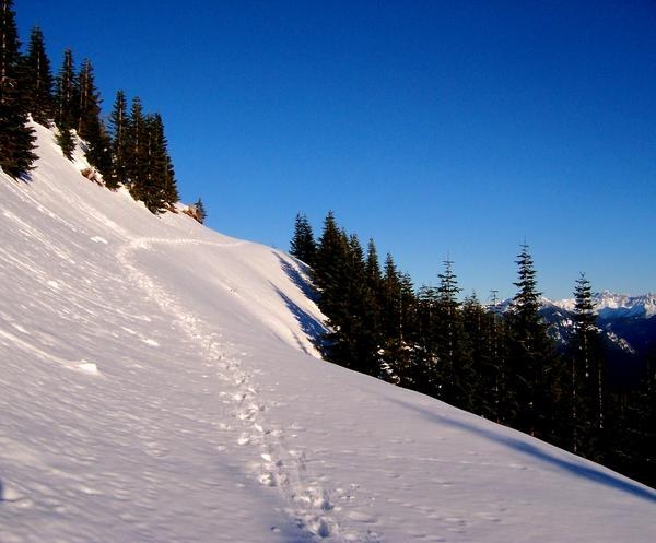
Springtime will bring flowers to the upper slopes and summer time is wickedly exposed to the sun. Traveling here in the winter has its’ merits. The access is year-round and the road makes for good snowshoeing. Although the avalanche risk is lower than many areas, the top of this peak should not be taken lightly. Do not be lulled into complacency by others’ tracks. Do not get summit fever and forego the need to assess the final summit slopes! The road you’ve been on pushes to within 100’ of the true summit. If that is where your journey ends, be grateful. Sit and enjoy some lunch. Take in the massive vista you’ve got. Consider the Middle Fork Snoqualmie below you being fed by the Pratt River and Rainy Creek and so many others. Consider how hard mankind has been to this region over the past 100 years. Consider how fortunate we are to have all this beauty in our backyard.
Pro Tip: If you are a peak bagger and want to extend your trip you may consider visiting Moolock Mountain. Moolock’s trail turns westward from the saddle mentioned above. Another summit in the area is the true summit of Bessemer. This is approximately three quarters of a mile distant from South Bessemer and there is NOT a trail to it. This route requires significant alpine cross-country experience and technical climbing. Do not be fooled by it’s seemingly close appearance.
 Trailhead


