
Whatever you like most about hiking, this trail has something for you, whether it’s a quick ascent, a period of more level ground, a peek-a-boo view, a quintessential Olympic Peninsula rain forest, or a ridge top.
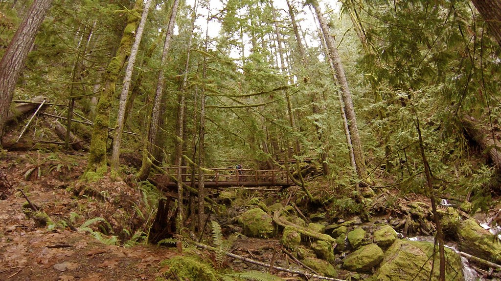
Begin your hike by parking off of Forest Service Road 2451. There isn’t room for many cars, so a hiker can usually find a bit of solitude here. Copper Creek is marked with a sign next to the road, and the narrow trail heads off up the left side of Copper Creek, which flows down the mountain.
Begin your ascent alongside the creek, and don’t forget to stop and admire two abandoned mine shaft openings at about 0.2 miles. These anachronisms date back to an effort from 1915 when miners searched the mountains for copper and manganese. “Copper” can also be found in the ruddy colored rocks that form the streambed. Follow the creek for about a half mile, climbing steadily the whole time and occasionally crossing the creek on several plank bridges. Then switch back up above the creek, gaining even more elevation. Be sure to look out through the moss-covered trees to glimpse small views of Lake Cushman far below. Keeping an eye on the lake gives you a sense of how fast you’re climbing. After this set of switchbacks the trail will even out to gives your legs and lungs a break, and you can soak in the old-growth forest: cedars, sword ferns, salal, and all the other usual forest life.
After about two miles, you’ll come to a sign announcing the “ridge loop.” To complete the loop turn either left or right. Turning right will give you a less steep ascent to the top of the ridge, a small ledge with a view facing west into the heart of the Olympics. From the viewpoint, continue around the loop to circle back to complete the lollipop loop trail and head back.
WTA Pro Tip: If there’s snow on the trail, use the orange diamond shaped markers to follow the route up the ridge. Be sure to stop at the ridge’s highest point to gaze out at the Olympic peaks before descending.
Copper Creek

-
 Length
- 5.0 miles, roundtrip
-
 Elevation Gain
- 2,400 feet
-
 Highest Point
- 3,200 feet
7.7.25: This trail and FR 24 are closed until further notice due to the Bear Gulch Fire.
Whatever you like most about hiking, this trail has something for you, whether it’s a quick ascent, a period of more level ground, a peek-a-boo view, a quintessential Olympic Peninsula rain forest, or a ridge top.
Continue reading
Hiking Copper Creek
Map & Directions
 Trailhead
Before You Go
7.7.25: This trail and FR 24 are closed until further notice due to the Bear Gulch Fire.
Parking Pass/Entry Fee
NoneWTA Pro Tip: Save a copy of our directions before you leave! App-based driving directions aren't always accurate and data connections may be unreliable as you drive to the trailhead.
Getting There
From Shelton, travel north on Highway 101 for 15 miles to Hoodsport. Head west on State Route 119 until reaching a T intersection. Turn left on Forest Road 24 and continue on a gravel road before turning left on FR 2451, crossing a causeway. After crossing over Copper Creek, there will be parking on the lefthand side. The trailhead is located east of Copper Creek.


