

From the trailhead, the trail climbs moderately through open rocky meadow, then enters the forest and shortly begins a descent to a large meadow. At 0.7 miles, it crosses an old logging road. The trail then traverses the side of the ridge through meadow and forest.
In about 0.25 miles, there is a relatively steep slope of sagebrush left of the trail. This slope tops out at the rim of Devil's Slide, an impressive cliff above the valley of Milk Creek. Exercise caution here at the top of Devil's Slide, especially with children.
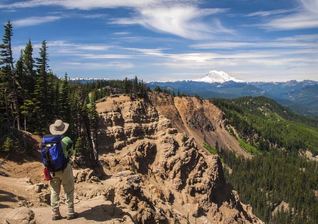
For the best views, walk the trail until it joins a double-track coming up from the valley below, and bushwack through the sagebrush to find a maze of game trails near the top. The views of the cliff are spectacular — there are also views out to Mount Rainier. The bushes will be covered with goat hair and you may get a chance to see the resident goat herd. Use care as you make your way along the top of the cliff and — when you’re ready — drop back down to the trail.
The trail — now a double-track — climbs moderately, mostly through forest, and at 1.9 miles crosses another double-track. A short ways further, the trail appears to end at a cul-de-sac of jeep roads and a wide open space. Follow the steep road to the left until it intersects a newer road surfaced with large gravel. Turn right onto this road — follow it about 10-20 yards and watch for the trail to your left just past a fallen tree. The trail from here is mostly single-track and climbs gently through alternating forest and wet meadows.
At about 2.5 miles, the trail enters the bottom of a large meadow sloping up to the Bald Mountain Road at the top of the ridge. The trail ascends along the bottom of the meadow but can become quite faint, so just walk up the meadow to the road. In late May or early June, this meadow is a carpet of glacier lilies and spring beauty. You can also find two species of pygmy lewisia (pygmaea and nevadensis) here. There are good views of Mount Aix, Nelson Ridge and Mount Rainier from the road.
For a longer walk, turn left and follow the Bald Mountain Road out Manastash Ridge, or down towards Manastash Lake and the area known as "Funny Rocks." A shorter option is to turn right and follow the road east maybe a mile through forest and meadow, and then along the ridge-top above the large lush basin at the headwaters of the Lefthand Fork of Rock Creek. Along the ridge are expansive views out to Mount Cleman and across the Naches River Valley to Mount Adams, Mount Aix, Nelson Ridge and Mount Rainier, as well as north to Mount Stuart and the Stuart Range. The little forested knoll at the end of the ridge is Bald Mountain itself. Return the way you came.
WTA Pro Tip: This area has multiple intersecting roads and jeep trails, so map reading skills are critical and a GPS is very helpful. The Gold Creek Trail is a motorized trail but receives fairly light use. The Bald Mountain Road is a Green Dot Road and gets moderate use, especially on weekends and during hunting season.
 Trailhead


