
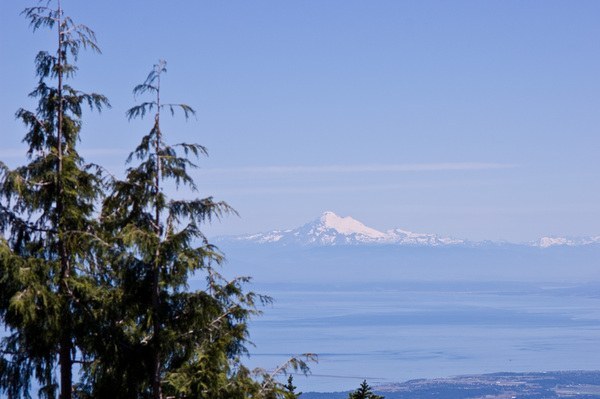

Climb and climb to a high alpine parkland. Along the way, take in the gorgeous views, massive trees, and fluffy mosses signature to the Hurricane Ridge area of Olympic National Park.
Beginning from the trailhead, set out on the Heather Park trail. To your left is the trailhead for Lake Angeles, a seven-mile round trip trail popular with visitors. You're likely to have fewer people for company on Heather Park, though.
The trail's well-maintained tread climbs almost immediately. You have to cover nearly 4000 feet of elevation gain in the next five miles to make it to Heather Park's 5740-foot high point and the trail wastes no time with flat forest rambling. The way is straightforward. There are no forks and the trail traverses, switchbacks, and traverses again through second growth forests of mountain hemlock, with some Alaska cedar sprinkled in towards the top. Anything standing still long enough is draped with muted green bearded lichen. Closer to foot, there are myriad mosses lining the trail.
Continue climbing, passing a large glacial erratic known as Halfway Rock. This marks, roughly, the halfway point of the climb to Heather Park. It's a little off to the left as you approach it, near a small gulley, so somewhat easy to miss. Take a breather here and enjoy the shade of the second-growth forest.
As you approach the top of the switchbacks, the forest thins, leading you to believe you might be nearing the top. You're flanking a top -- First Top, the not-quite summit of your hike. This last section can be frustrating, as it constantly feels like you're nearing the top, but you've still got a mile before you make it to Heather Park. At least the views are stunning, and after one last push into a small hanging valley, you're in the low part of the bowl that makes up the park.
A small trickling creek and campsites are here. The first site marks the elevation gain and mileage indicated in this writeup, but it's possible to press on higher and another quarter mile further to a saddle, where the trail drops away and the views to the south are stunning. Call it quits here -- you've done plenty of elevation gain and now you've got to lose it all on the way down.
WTA Pro Tip: If you're feeling adventurous, you can continue down the saddle. This sometimes-scramble over gravelly rock connects with the Klahhane Ridge trail and eventually the Lake Angeles Trail, completing a loop that ends right back where you started.
But the section leading out of Heather Park is rough, and suitable only for experienced hikers with a map and route-finding skills. A sign at the trailhead warns that hikers have become lost on this section of trail when caught by darkness or fog.
 Trailhead


