

These hot springs are a popular destination for visitors from all over the world, but there are a number of interesting stops along the way. Consider the 0.1 mile trail to the beautiful Madison Creek Falls, a picnic stop along the Elwha River, and an incredible look at the site of the former dam at Glines Canyon.
This hike is more of a road walk. The path is wide and smooth and would be good for hikers of all ages. Past Madison Creek Falls you'll cross the washout of the road at 0.88 miles. Here, the trail ducks into the forest to route around a feeder stream that has caused the road washout. It rejoins the former road past the washout and continues on from there.
2.45 miles from the traihead, just after crossing a bridge over the Elwha, you pass the Altair campground. Now closed to overnight stays, the campground does provide a nice place to sit and enjoy the valley, as well as another place you might consider turning around if you don't want a super-long hike.
Another 1.1 miles along the trail, arrive at Glines Canyon Overlook. This is the former site of a dam that was removed in 2014, and now provides a fascinating look back at the interpretive site that was much more visited when you could drive to it. It's also an excellent stopping point - from here it's more than 7 miles to the hot springs, with few big overlooks or good stopping points.
Continuing past the overlook, the road begins climbing in earnest. It's another 4 miles to the entrance to Olympic National Park along this road lined with madrona trees and evergreens.
Two miles from the hot springs, you'll arrive at the wilderness boundary. If you're using a bike, you'll have to leave it at the kiosk as there are no bikes allowed past this boundary.
Here too, the road narrows and begins to feel more like a trail, though it's still fairly wide: two people can walk side-by-side. After climbing for 1.3 miles, the trail begins descending quite steeply, passing a large landslide you'll need to clamber over, and then crossing Crystal Creek on a log bridge (the suspension bridge washed out in a flood!)
From here begin climbing again, rounding a corner. You're on your last push! Pass a spur trail to Boulder Creek campground, where you can use the outhouse if you need it. Then take the trail down to the left. After another quarter mile, you will cross the bridge over Boulder Creek. Take a moment to snap some pictures of the beautiful creek and admire the hard work of the bridge builders.
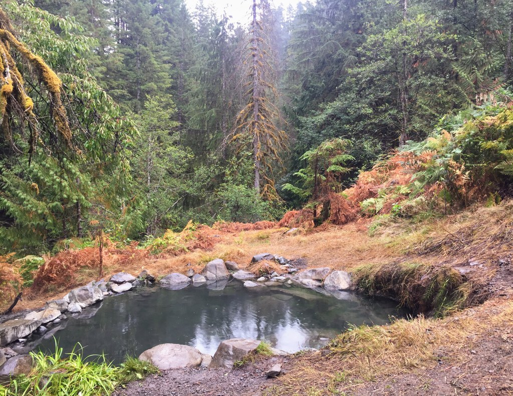
Once you're on the other side, you're in hot spring territory. Some pools are right along the trail, others are a bit more secluded. When you find one you like, be sure to test the temperature; some can be as high as 118 degrees.
The National Park Service warns that these pools "are not monitored or maintained and may contain high levels of fecal coliform bacteria". This doesn't stop hot spring lovers from enjoying a soak in their bathing suit or birthday suit.
 Trailhead


