
This is an abandoned trail that heads south along Rainy Creek off of the downstream section of the Middle Fork Snoqualmie Trail up to Rainy Lake. The lake is popular among fishermen, since it is home to lots of trout, but be warned — route-finding skills are a must on this trip.
On the far side of the bridge from the parking lot, turn right and follow the wide, WTA-built Pratt Connector trail until it crosses Rainy Creek. The Pratt Connector was a three-year project for WTA, utilizing hundreds of volunteers to create a safe way for hikers to access this side of the river. Before the trail was constructed, many hikers were fording the river, a dangerous attempt. Now a wide trail leads hikers through airy forest and large granite boulders along the side of the mighty Snoqualmie River.
About a half-mile down the trail, cross the sturdy bridge over Rainy Creek. Just beyond the bridge, take a small spur trail as it executes a neat switchback up and away from the Pratt Connector. This is the Rainy Lake trail, which hugs the west side of Rainy Creek for the entire length of the trail.
Follow the narrow, sometimes very faint boot path through lush forest and mossy undergrowth. Rainy Creek is your constant companion as you follow it ever upward toward the lake. The path alternates between brutal inclines and occasional plateaus, over a few blowdowns and straight up talus fields. The occasional views of Mount Garfield are excellent and the faint trail lends a pleasant feeling of seclusion. Near your destination, climb a little higher than the lake to cross over a rounded ridge and then descend to the outlet stream.
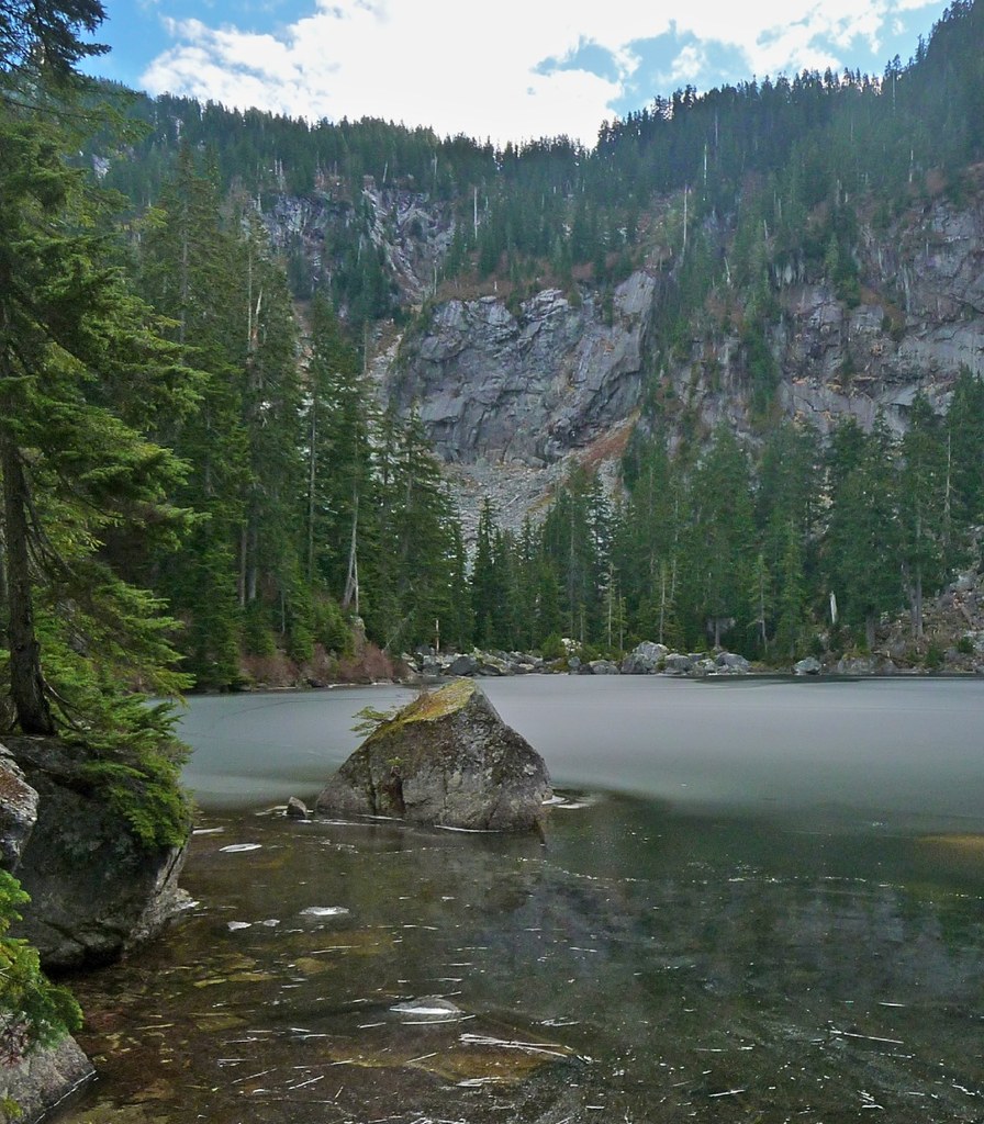
Rainy Lake lies beneath the exposed rock face of Preacher Mountain. It's not been officially maintained for years, so it does not make for an easy or quick side trip, but it's a worthwhile endeavor for those seeking a more solitary adventure or a challenging hike. Certainly Rainy Lake would be a great base camp for those who want to summit Preacher or the Pulpit, but it is also a lovely and peaceful destination in itself.
Rainy Lake

-
 Length
- 8.0 miles, roundtrip
-
 Elevation Gain
- 2,900 feet
-
 Highest Point
- 3,900 feet
This is an abandoned trail that heads south along Rainy Creek off of the downstream section of the Middle Fork Snoqualmie Trail up to Rainy Lake. The lake is popular among fishermen, since it is home to lots of trout, but be warned -- route-finding skills are a must on this trip.
Continue reading
Parking Pass/Entry Fee
Northwest Forest PassHiking Rainy Lake

WTA worked here in 2007!
Map & Directions
 Trailhead
Before You Go
Parking Pass/Entry Fee
Northwest Forest PassWTA Pro Tip: Save a copy of our directions before you leave! App-based driving directions aren't always accurate and data connections may be unreliable as you drive to the trailhead.
Getting There
From Seattle drive east on Interstate 90, take Exit 34 (signed 468th Avenue), turn left under I-90, pass Seattle East truck plaza and convenience stores (also known as Ken's Truck stop), then turn right on Road No. 56 (Middle Fork Snoqualmie Road). Where the road splits, you can take either fork as the roads rejoin. Continue just under 12 miles to the Gateway parking area and Middle Fork trailhead, elevation 1,000 feet.


