

The Walking Ebey’s Trail System highlights the rural, agricultural landscapes on Whidbey Island while providing hikers with the opportunity to get up close and personal with working farms as they follow a thin strip of conservation easement on their hike. Enjoy the ability to choose your own adventure and explore three of the island’s parks — Admiralty Inlet Natural Area Preserve, Prairie Wayside and Rhododendron Park — on a European-style walk across the land.
This is just one way to explore the area (7 miles with 180 feet of elevation gain) — there are many ways you can tweak it to make it your own hike.
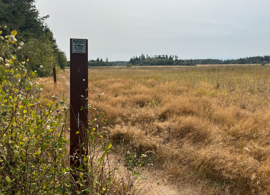
Once you arrive at the parking area, the Walking Ebey’s Trail leads you northeast and into a small stretch of forest before you step out into the farmland of Whidbey Island. The parking lot is shared with Admiralty Inlet Natural Area Preserve, a conservation site featuring the natural bluffs and a small, rare prairie ecosystem — it’s worth exploring either before or after your hike on the Walking Ebey’s Trail.
For now, continue following a wide grassy path that walks between working modern farms on the island. The edge of the trail is dotted with posts with the Whidbey Camano Land Trust logo to help keep you on the right path. Arrows direct you around corners which give the trail a strange shape made up of sharp turns to respect private property boundaries.
After 0.65 miles, you’ll reach a junction between the three forks of the Walking Ebey’s Trail. If you turn left, you’ll be set to walk another 0.65 miles to the parking area and view of the wide-open prairie and fields at Prairie Wayside.
If Rhododendron Park is your chosen destination, follow the trail straight ahead and continue to follow the signs for another 2.85 miles As you walk you’ll travel over rolling pasture for local cattle, walk past walls of snowberry and native rose bushes, pass under brief stands of trees providing much-needed shade, and hear as garter snakes, rabbits, robins, and other small wild creatures duck away from you in the bushes.
As you hike, please be respectful of posted signs from landowners. The trail passes through narrow strips of public land bordered by private property. Stay on the trail and do not trespass or feed livestock. There are also several major, unprotected road crossings located at Engles Rd needed to reach the Prairie Wayside parking area and at Fort Casey Rd about halfway between Rhododendron Park and the other parking areas — use extreme caution when crossing the road.
Once you arrive at Rhododendron Park, you will return to the woods and have the option to extend your trip on the park’s three miles of trails. The park is best hiked in the spring while the many rhododendrons are blooming, but in other seasons the park provides some of the only shade in the trail system or an overstory to protect you from rain.
 Trailhead


