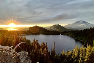

The trail from Mowich to Longmire along the Wonderland Trail is an enchanting hike. While the Wonderland trail encircles all of Mount Rainier, you can enjoy a shorter time on trail with this shorter section.
Even so, it is a strenuous hike with ample elevation gain and loss through lowland forests, valleys, into high alpine and sub-alpine areas. You move through forests with moss and ferns, wildflower-filled rolling meadows, and along hillsides covered in beargrass and thick with huckleberry bushes.
Hikers will amble along on soft pine needle-blanketed dirt, over roots and rock, up staircases built from logs and cross bridges over creeks, rivers and streams. The forest along the way teems with wildlife. Look for bear, deer, marmots, pika, elk, and of course birds.
The route begins at Mowich Lake at the trailhead labeled for Spray Park. Enter the woods behind the Mowich campground and go downhill for a quarter-mile to a junction directing you left to Spray Park and right for the Wonderland Trail.
Stay right here. You will continue to descend through the forest over roots and dirt, with the sound of Carter Creek. A mile from the junction, the trail begins a steeper decline for the next half mile, leading you over foot bridges and a narrow trail. Three miles in, you will reach the Paul Peak trail junction to your right.
Continue the Wonderland trail to the left, following the trail down to the North Mowich River at 3.5 miles from the trail head. A log bridge here crosses the swift water of the river. Be cautious. You may have better luck if you try to cross early in the morning, as water rises as the day progresses.
A half mile past the North Mowich River, you will arrive at the South Mowich River. Similar to the previous crossing, try to hit this early in the day. Check park information before your hike for up to date information.
Shortly after the South Mowich river crossing, switchbacks quickly guide you uphill. 8.5 miles in, you will reach Golden Lakes, the largest lake to your right. Here, the trail is lined with huckleberries and beargrass, open meadows and a series of small lakes. Be bear aware as you feast on berries; on a hot summer day, the trail smells like hot huckleberry pie.
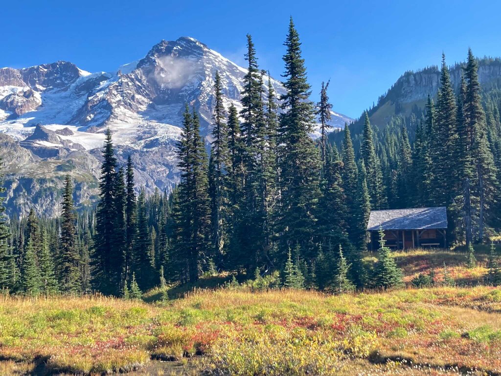
9 miles in, a short side trail to the right leads you to the Golden Lakes camp and a historic patrol cabin.
Another two miles past the junction to Golden Lakes, you will enter a 1930s Era Fire Burn Zone. A silver forest with a blanket of huckleberry bushes, bear grass and small trees. Views of Mount Rainier are seen as you continue as you wind through on a dirt path.
Another 2.5 miles ahead, cross the North Puyallup River and a junction with the North Puyallup Trail. You will continue forward on the Wonderland Trail and begin the climb with sweeping views of the North Puyallup river and the headwalls at the end of the former Westside Road.
Continue on to climb the steepest section of trail on the Wonderland Trail for over two miles up with glimpses of Mount Rainier, Aurora Park and on to Aurora Lake at Klapatche Ridge on your left and the junction for St. Andrews Creek Trail on your right. This junction is 16.5 miles from your start at Mowich lake.
Less than a mile after Aurora Lake, you will reach St. Andrews Lake on your left and Saint Andrews Creek and shortly after the lake, you will come to a meadow bursting with wildflowers. This is Saint Andrews Park.
Continue your hike another mile and half to the South Puyallup River. Once you cross this river, the trail junctions to to left and right. A left turn will continue along the Wonderland Trail. A right turn is the South Puyallup Trail. If you have time or just need a privy, a side trip into the South Puyallup camp to the privy in the woods will take you past andesite columns known as “the Colonnades” a fascinating geological formation.
Climbing uphill again, you will climb to the top of Emerald Ridge, an open hillside of grass, wildflowers and speckled with rocks. Watch for deer, marmots and bears. Pause for a moment and enjoy the view of Mount Rainier and the glacier that feeds the South Puyallup River below.
As you descend off Emerald Ridge, the landscape changes to a rocky terrain and you will pass the junction for Tahoma Creek Trail on your right and cross Tahoma Creek over a suspension bridge. The 150 foot long, 200 foot high suspension bridge crosses above the Tahoma Creek below. Just over a mile past Tahoma Creek, a side trail for Mirror Lakes to your left is an unmaintained trail with small lakes that reflect views of Mount Rainier. This area is known as Indian Henry's Hunting Ground. Not far past this junction, look to your left as you pass by Indian Henry’s Patrol Cabin. This Patrol Cabin is the oldest patrol cabin in the park, built in 1915. Shortly after, a trail to the right leading to the Kautz Creek Trail.
Just over half mile from Kautz Creek Trail junction, Squaw Lake may be seen on the left. Late in the season, this lake may be dry. Devil’s Dream camp sits tucked in the trees just beyond Squaw Lake. Two miles after Squaw Lake, you will descend switchbacks and arrive at Pyramid Creek - another glacier fed river with a half log bridge crossing. Shortly after, reach Pyramid Creek Camp on the left.
In 0.3 miles you will cross Kautz Creek. Some seasons, this Creek is dry. Other seasons there may be water. Two miles after Kautz Creek crossing, you will come to a junction for Rampart Ridge Trail to your right and 0.2 miles after Rampart Ridge, a junction for Comet Falls and Van Trump Trail to the left.
Continue another 1.2 miles where the trail meets up with the Longmire Paradise Road. Watch for traffic as you cross the road and continue on the Wonderland Trail just across the road. After a short walk through the woods, a junction to continue on the Wonderland trail is signed to the left and the trail to Longmire is to the right. In just a short distance, you arrive at Longmire.
 Trailhead