Barrier-Free Trails
Finding a wheelchair-friendly trail can be challenging. In addition to general information about what you see along the way, wheelchair hikers need to know things like the cross slope (it can affect how a chair performs.) They also need to know the type of surface they'll be traveling on, and the angle of the trail itself — how steep is it?
Trails don't have to specifically be designated ADA-accessible to be wheelchair friendly, but it helps. If they don't meet ADA requirements but they're wide enough for a wheelchair, trails are called 'barrier-free'. That means that in ideal maintenance conditions, a wheelchair hiker could navigate their way along the route.
We've compiled this list of our favorite barrier-free hikes, though there are many more out there. Get inspired, head out, and of course write a trip report when you're back! While this list has been assembled with wheelchair-hikers in mind, it's a useful resource if you're hiking with a stroller or walker as well.
Northwest Washington
Semiahmoo Spit
Location: Bellingham area
Mileage: 1.6 miles, roundtrip
Elevation Gain: none
Trail Type: Paved
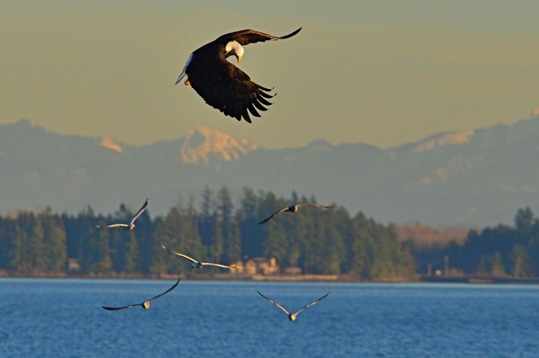
An eagle tries to get some dinner. Viewed from the Semiahmoo Spit trail. Photo by trip reporters Bob and Barb.
This paved trail on a sandy spit outside of Bellingham is a birdwatcher's paradise - lots of previous trip reporters have gotten incredible photos of eagles, kingfisher, mergansers, and many other types of birds of prey and waterfowl. If the birds don't do it for you, maybe the gorgeous views of Mount Baker, Twin Sisters, and other snowy North Cascades peaks will.
> Plan your trip to Semihamoo Spit using WTA's Hiking Guide
Hertz Trail
Location: Bellingham area
Mileage: 6.2 miles, roundtrip
Elevation Gain: 100 feet
Trail Type: Packed Dirt

Lake Whatcom on a cloudy day from the Hertz Trail. Photo from WTA archives.
With only 100 feet of elevation gain, this trail provides a nice way to spend time outside and get views from the lakeshore. Be sure to check trip reports before you go; sometimes downed trees can block the path, but usually the way is clear. There are plenty of distractions along the way in the form of streams and waterfalls. In autumn, the trees blaze with color, reflecting in the lake's surface.
> Plan your hike on the Hertz Trail using WTA's Hiking Guide
Padilla Bay
Location: Bellingham Area
Mileage: 4.4 miles, roundtrip
Elevation Gain: minimal
Trail Type: Paved and hard-pack gravel. You'll need a key to unlock the wheelchair gate, which is available at the Brezeale Interpretive Center
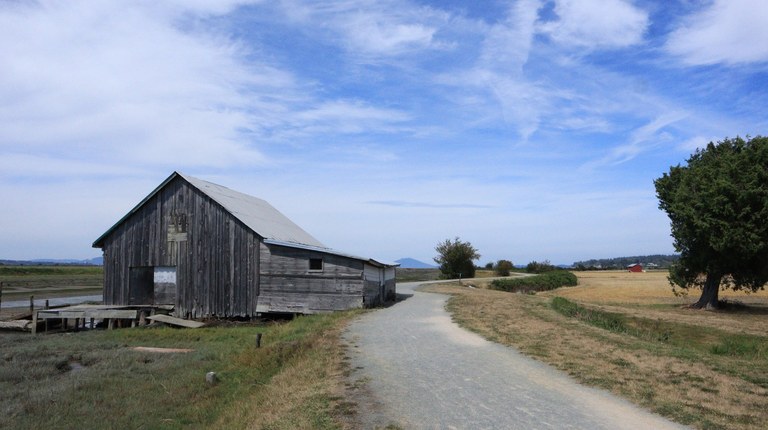
An old building along the trail at Padilla Bay. Photo by trip reporter Philosopher.
Set amid eel grass flats that provide food and shelter for numerous bird species in the North Sound, Padilla Bay offers extensive bird-watching, and striking views of the coast, mountains and farmlands to boot!
> Plan your visit to Padilla Bay using WTA's Hiking Guide
North Cascades
Fire and Ice Trail at Artist Point
Location: Mount Baker Area
Mileage: 0.5 miles, roundtrip
Elevation Gain: 100 feet
Trail Type: Gravel
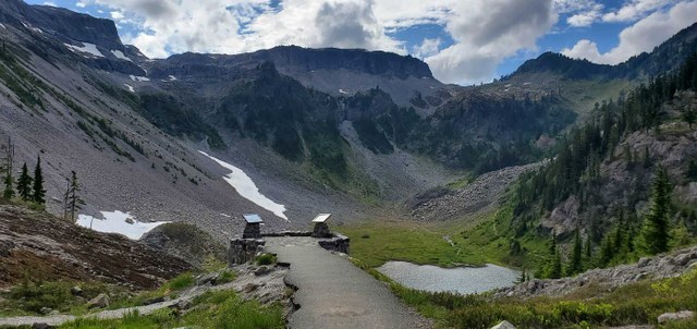 Beautiful views can be found just a short hike from the Artist's Point parking lot. Photo by trip reporter standingsnowcrab.
With a name like Artist Ridge, it should be no surprise that views along this popular hike are, in a word, spectacular. Alpine meadows provide a stunning foreground for views of the North Cascades' grand peaks, inspiring photographers, painters and casual visitors alike on even the grayest of days.
> Plan your visit to the Fire and Ice Trail using WTA's Hiking Guide
Rasar State Park
Location: Highway 20
Mileage: 3.0 miles, roundtrip
Elevation Gain: 20 feet
Trail Type: Packed Dirt
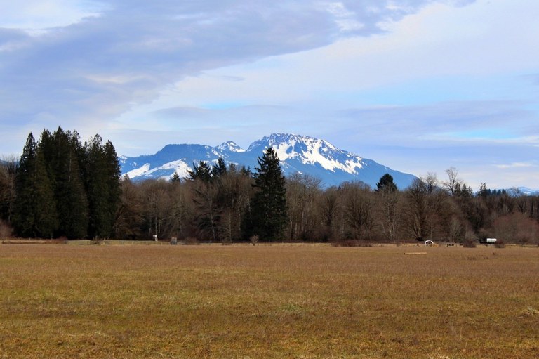
The ADA trail at Rasar State Park goes through the Field area of the park, offering excellent view. Photo by trip reporter OneHundredMilesAYear.
Rasar State Park is home to forest, fields, and riverside rambling. Though many of the trails may be navigable by a wheelchair, there is an ADA-designed trail here. It is accessible from the back of the campsites, one mile long, and is marked on the maps in the area as Trail #8.
> Plan your hike at Rasar State Park using WTA's Hiking Guide
Gorge Overlook
Location: Highway 20
Mileage: 0.53 miles, roundtrip
Elevation Gain: 70 feet
Trail Type: Paved, then gravel
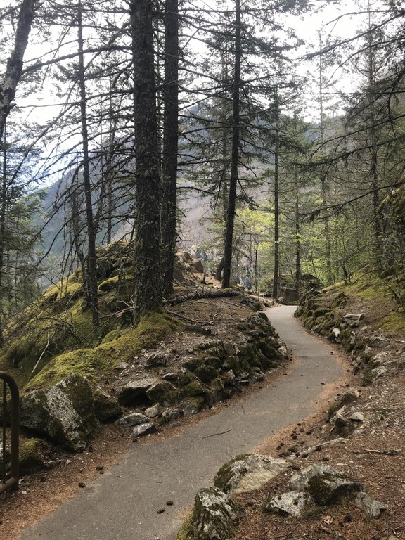
The Gorge Overlook trail is a nice stopping spot to get views just off Highway 20. Photo by Anna Roth.
This very short trail provides astonishing views of nature’s beauty as well as humanity's technological “improvements” upon it (in the form of dams that provide hydroelectric power to Washington residents). Half this loop is paved, allowing an out-and-back, while the remaining graveled loop section is not steep and could be managed by a wheelchair user with help.
> Plan your visit to the Gorge Overlook Trail using WTA's Hiking Guide
Washington Pass Overlook
Location: Methow Valley
Mileage: 1.0 mile, roundtrip
Elevation Gain: 10 feet
Trail Type: Paved, then gravel
 Another great stopping spot on Highway 20, Washington Pass Overlook is stunning, though the full loop is unfortunately not wheelchair friendly. Photo from WTA archives.
Some of the best views of the North Cascades can be had from the viewpoint at the Washington Pass Overlook. The first 200 yards of this trail are wide, nearly flat and paved, leading to an absolutely breathtaking view of the dramatic North Cascades peaks.
> Plan your visit to Washington Pass using WTA's Hiking Guide
Central Cascades
Gold Creek Pond
Location: Snoqualmie Pass
Mileage: 1.0 mile, roundtrip
Elevation Gain: 10 feet
Trail Type: Paved
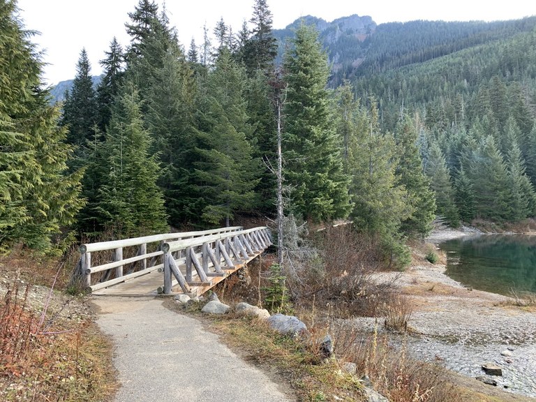
Gold Creek Pond. Photo by trip reporter CiscoKitty.
Within eyeshot of the Alpine Lakes Wilderness lies this lovely, fully ADA-accessible mountain pond. Take a picnic with you and soak in the mountain views, crystal-clear water and blooming wildflowers while ambling along this one mile loop. Double check trip reports here in the shoulder season; late season snow can make this trail impassable for wheelchairs.
> Plan your visit to Gold Creek Pond using WTA's Hiking Guide
Iron Goat Loop
Location: Stevens Pass - West
Mileage: 0.5 - 6.0 miles, depending on the trail conditions
Elevation Gain: ~700 feet
Trail Type: Barrier-free interpretive trail on converted railroad grade
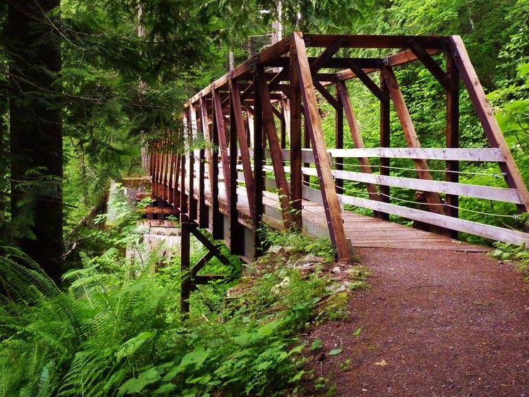
The old railroad grade of the Iron Goat Loop makes for a great barrier free trail. Photo by trip reporter jbk51691.
Built on reclaimed railroad grade, the Iron Goat Loop's wealth of both history and natural beauty make it a perfect trip for everyone in your hiking group. Several barrier-free interpretive trails allow all visitors a chance to enjoy this beautiful area.
> Plan your visit to the Iron Goat Trail using WTA's Hiking Guide
Enchantment Park
Location: Leavenworth Area
Mileage: 2 miles, roundtrip
Elevation Gain: minimal
Trail type: Packed Dirt
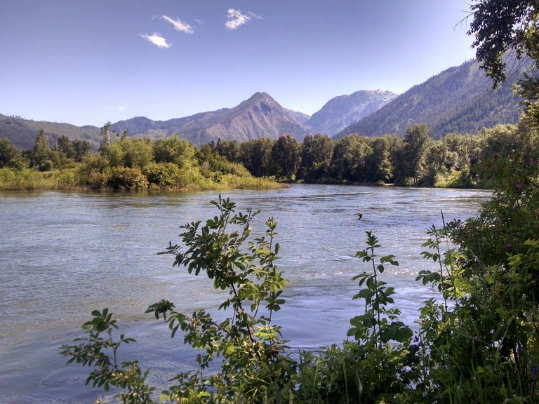
The Wenatchee River at Enchantment Park. Photo by trip reporter sharon.
Located just adjacent to the Wenatchee River, Enchantment Park is part of a large network of trails and parks in downtown Leavenworth. The trails are dotted with informative plaques all along their length, and the ample signage offers glimpses into the history of the area, facts about the wildlife or vegetation that surrounds you, or an interesting bit of information about the section of trail you're on.
> Plan your visit to Enchantment Park using WTA's Hiking Guide
South Cascades
Trail of the Shadows
Location: Mount Rainier National Park - Longmire
Mileage: 0.7 mile, roundtrip
Elevation Gain: 20 feet
Trail Type: Packed Dirt and boardwalk
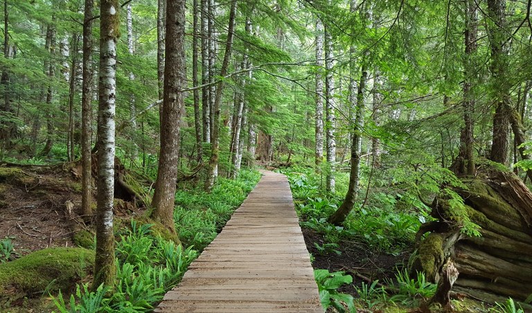
A boardwalk along the Trail of the Shadows trail. Photo by trip reporter Impromptu Disco.
A short loop trail, this little walk provides an opportunity for visitors to appreciate the history of Longmire while immersing themselves in nature. The boardwalk may be a bit narrow for some wheelchairs, but even skipping the boardwalk section gives you some beautiful time on trail in a lovely national park.
> Plan your hike on the Trail of the Shadows using WTA's Hiking Guide
Clear Lake Interpretive Trail
Location: White Pass/Cowlitz River Valley
Mileage: 0.5 mile, roundtrip
Elevation Gain: minimal
Trail Type: Paved and gravel

A platform at the end of the Clear Lake Interpretive Trail. Photo by trip reporter BeaverDawg.
Located on the north shore of Clear Lake, this interpretive trail forms a lollipop loop on a paved trail that is flat and less than a mile in length, making it the perfect short outing. The trail starts out from the Clear Lake Day Use Area parking lot.
> Plan your visit to Clear Lake using WTA's Hiking Guide
Meta Lake and Miner's Car
Location: Mount St. Helens
Mileage: 0.6 mile, roundtrip
Elevation Gain: minimal
Trail type: Paved

The boardwalks along the Meta Lake trail weave through the landscape. Photo by trip reporter ejain.
Walk a paved path to an observation deck at the edge of little Meta Lake. Learn how certain life forms survived the 1980 eruption and how this small body of water helped the regeneration of life within the blast zone. Then walk another paved path to a different outcome — a demolished car belonging to three people who perished from the forces of Mount St. Helens. The road to Windy Ridge opens late in the season, so double-check that it's open before heading there.
> Plan your visit to Meta Lake and the Miners Car using WTA's Hiking Guide
Seaquest State Park - Silver Lake Boardwalk
Location: Mount St. Helens Area
Mileage: 1.0 mile, roundtrip
Elevation Gain: 100 feet
Trail Type: Boardwalk, packed dirt
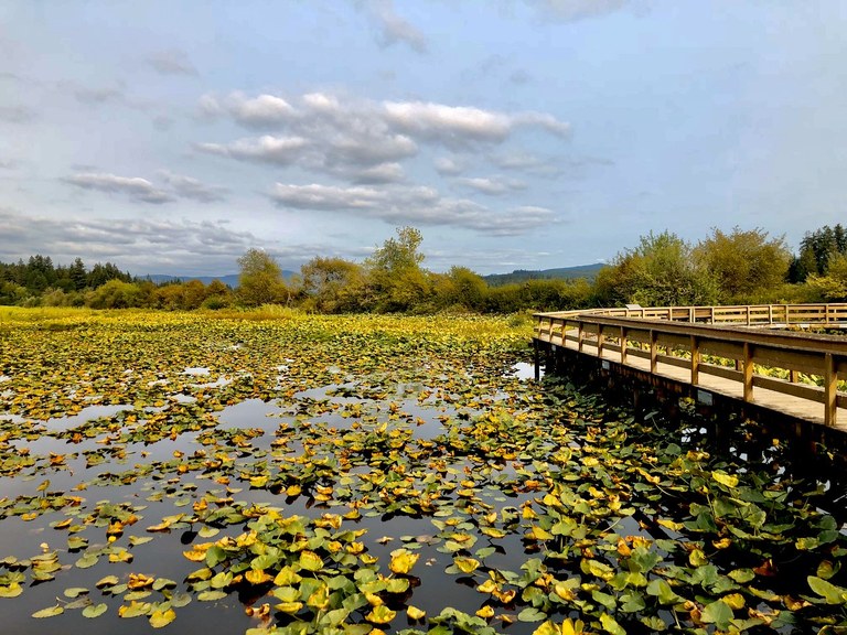
A stretch of boardwalk extending into the lake immerses visitors in nature. Photo by trip reporter Liz M.
Mount St. Helens may be on full display at Silver Lake (an accessible telescope is often available for close-up volcano viewing), but it's best to keep your eyes on the lakes and forests along the trail. A haven for local wildlife, Silver Lake might just treat you to a glimpse of deer, elk, owls or even bear!
> Plan your hike at Seaquest State Park using WTA's Hiking Guide
Southwest Washington
Catherine Creek Universal Access Trail
Location: Columbia River Gorge
Mileage: 1.5 miles, roundtrip
Elevation Gain: 120 feet
Trail Type: Paved
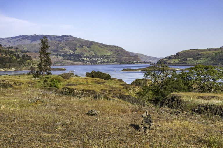
The Universal Access Trail is a paved route offering expansive views. Photo by trip reporter HaroldC3.
Catherine Creek offers a veritable feast for the eyes for all Columbia Gorge visitors. Starting at a parking lot overlooking the Columbia River are two ADA-accessible trails; an easy .25 mile route and a much-more-challenging 1.25 mile route, on which you'll likely need assistance getting up and down. Either way, you'll wind through open meadows with gorgeous views. WTA has also built a third barrier-free trail at nearby Cape Horn.
> Plan your hike at Catherine Creek using WTA's Hiking Guide
St. Cloud
Location: Columbia River Gorge - WA
Mileage: 1.0 miles roundtrip
Elevation Gain: none
Trail Type: Compacted Gravel

Apple trees and a picnic table in fall at St. Cloud. Photo by Ryan Ojerio.
Five miles downriver from Beacon Rock State Park is a lovely little park with a one-mile barrier free route through an old apple orchard and open meadows. Enjoy a picnic or the river views, and look out for migratory birds and waterfowl.
> Plan your trip to St. Cloud using WTA's Hiking Guide
Klickitat Rail Trail
Location: Columbia River Gorge - WA
Mileage: 10.5 miles, roundtrip
Elevation Gain: 200 feet
Trail Type: Paved

Fall on the Fisher Creek Trestle on Klickitat. Photo by Susan Saul
This first section of the 31-mile Klickitat Trail is a rails-to-trails conversion from Lyle to Warwick (on the Lyle-Centerville Highway), with several access points along the way. The Klickitat River section runs 10 miles upriver from Lyle to the hamlet of Pitt paralleling the river the entire way. This is a multi-use trail, so expect to see bicyclists and equestrians along the way.
> Plan your visit to the Klickitat Trail using WTA's Hiking Guide
Puget Sound and Islands
Billy Frank Jr. Nisqually National Wildlife Refuge
Location: Olympia
Mileage: 5.0 miles roundtrip
Elevation Gain: minimal
Trail Type: gravel to boardwalk
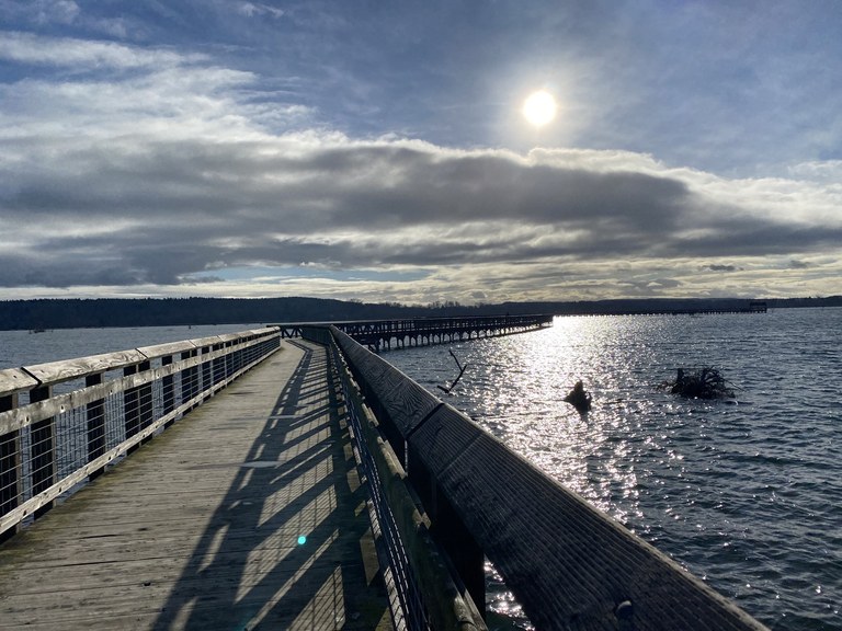
Long stretches of boardwalk at the Billy Frank Jr. Nisqually NWR are extraordinary. Photo by trip reporter cristina.
The National Wildlife Refuge at Nisqually is a simply gorgeous trail just a few miles off of I-5, making it an ideal stop during a trip. A spot where migratory birds congregate and the boardwalk is fascinating whether the tide is in or out, be sure to stop here.
> Plan your visit to Billy Frank Jr. National Wildlife Refuge using WTA's Hiking Guide
Cedar River Trail
Location: Tacoma
Mileage: 17.4 miles, one-way
Elevation Gain: 820 feet
Trail Type: paved
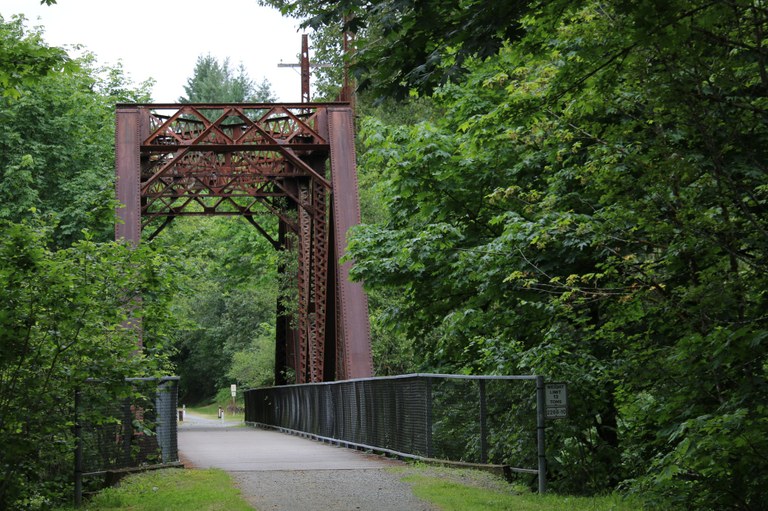
The Milwaukee Trestle bridge on the Cedar River Trail. Photo by wafflesnfalafel.
With access points all along the nearly 18-mile trail, the Cedar River Trail offers an urban river outing, a more rural experience wandering along a former rail bed, and a roadside bicycle path connecting the two. Tackle the entire trail, or select one section.
> Plan your trip on the Cedar River Trail using WTA's Hiking Guide
Seward Park
Location: Seattle
Mileage: 2.4 miles, roundtrip, for perimeter trail
Elevation Gain: minimal
Trail Type: paved
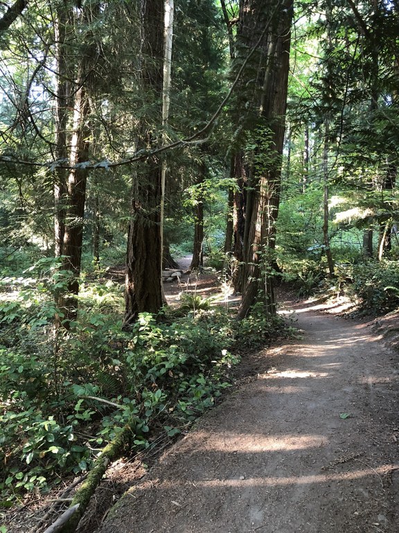
Winding trails through the center of Seward Park. Photo by trip reporter brad_f.
Wheelchair users heading for Seward Park can enjoy a flat hike around the perimeter of the park on a paved trail, with views of Seattle and Mount Rainier. Those with chairs that can handle a little more rugged routes could head into the center of the park for a more hilly adventure. In some places, you may want a friend for an assist on the ups and downs.
> Plan your visit to Seward Park using WTA's Hiking Guide
Olympic Peninsula
Hurricane Hill
Location: Northern Coast
Mileage: 3.2 miles, roundtrip
Elevation Gain: minimal
Trail Type: paved to gravel
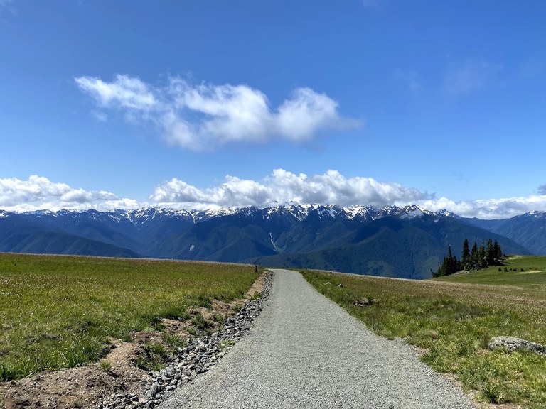
Hurricane Hill offers some of the most epic mountain views in Washington. Photo by trip reporter b555.
The trail on Hurricane Hill leads to a blustery summit, but along the way, you'll find gorgeous views along a moderately graded trail. If you're in a manual chair, you may need a little help along the way, but be sure to head for the summit — interpretive signs label the surrounding peaks as well as the scars left from various fires that have burned in the area.
> Plan your hike at Hurricane Hill using WTA's Hiking Guide
Mima Mounds
Location: Olympia
Mileage: 2.75 miles, roundtrip
Elevation Gain: minimal
Trail Type: paved
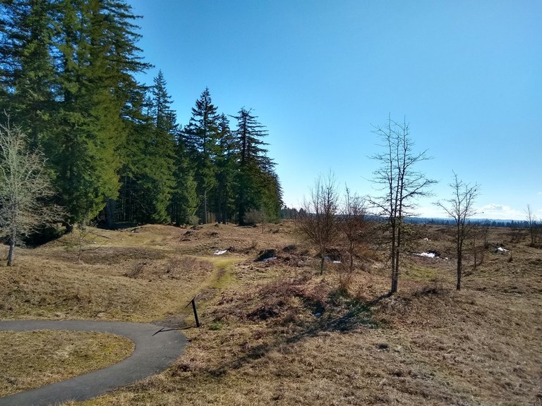
Paved trails wind through the unique landscape at Mima Mounds. Photo by trip reporter Fishlady.
These mysterious mounds inspire imagination and speculation among visitors. With a half-mile ADA accessible path and another two miles of more rugged wandering, the Mima Mounds are a great destination for many hikers.
> Plan your hike at Mima Mounds using WTA's Hiking Guide
Spruce Railroad
Location: North Coast
Mileage: 2.0 miles, roundtrip
Elevation Gain: 250 feet
Trail Type: Paved dirt and boardwalk
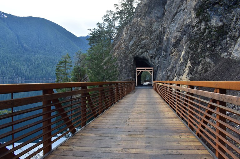
A new bridge and tunnel on the Spruce Railroad Trail. Photo by trip reporter Ravenridge.
The Spruce Railroad Trail is getting updated to be more wheelchair friendly, and the most recent renovations have made big moves in that direction. Currently hikers visiting should start from the east end for the longest uninterrupted stretch. Starting on the west end, you'll have a much shorter hike (a bridge lacks a ramp currently), but it's a very scenic area: Devil's Punchbowl is a popular location to stop for photos.
> Plan your visit to Spruce Railroad using WTA's Hiking Guide
Ruby Beach
Location: Pacific Coast
Mileage: 740 feet
Elevation Gain: minimal
Trail Type: Gravel

From the parking lot overlook. Photo by trip reporter Kiwimi.
Of all the beaches on the Olympic Coast, the Ruby Beach trail is the only one wide enough for a wheelchair to reach the beach. But visitors will still need to be prepared for a rough route — drainages crossing the trail make it a bit rough, and it can be steep. Bring a friend.
> Plan your Ruby Beach visit using WTA's Hiking Guide
Eastern Washington
Columbia Plateau Trail
Location: Spokane area
Mileage: 48 miles of ADA-accessible trail
Elevation Gain: minimal
Trail Type: Paved and gravel
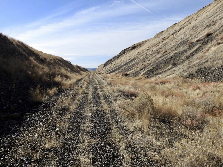
A gravel paths along the Columbia Plateau Trail. Photo by trip reporter dschoonover.
Pick your own adventure on this 143-mile stretch of reclaimed railroad that extends from Spokane to Pasco. Though most accessible at the Cheney Trailhead, this railroad trail includes ADA-accessible hikes through the Turnbull National Wildlife Refuge, and graveled routes at the Snake River Junction Trailhead.
> Plan your outing on the Columbia Plateau Trail using WTA's Hiking Guide
Children of the Sun
Location: Spokane
Mileage: 10.0 miles of ADA-accessible trail
Elevation Gain: minimal
Trail Type: Paved

On the Children of the Sun trail outside of Spokane. Photo by trip reporter Lord Business.
This trail outside of Spokane is a class A paved trail. It parallels the new North Spokane Corridor from the Little Spokane River to Hillyard. Eventually it will connect with the Centennial Trail. The trail will be extended as road construction continues.
> Plan your walk on the Children of the Sun trail using WTA's Hiking Guide
Sacajawea Historical State Park
Location: Spokane area
Mileage: 0.5 miles of ADA-accessible trail
Elevation Gain: minimal
Trail Type: Paved and gravel
Nestled on the eastern edge of the Tri-Cities, just east of Pasco, is a lovely little state park and accompanying interpretive center dedicated to Sacagawea, the Shoshone woman who was crucial to the success of the Corps of Discovery as they made their way to the Northwest Coast.
> Plan your visit to Sacajawea Historical State Park using WTA's Hiking Guide
Central Washington
Wenatchee Confluence State Park - Horan Natural Area
Location: Wenatchee area
Mileage: 2.5 miles, roundtrip — and extends to the 10 miles of Apple Capital Trail
Elevation Gain: minimal
Trail Type: Paved and gravel

A bench for resting at the Horan Natural Area in Wenatchee Confluence State Park. Photo by trip reporter terradactyl.
Take the paved Apple Capital Trail to a lovely art-deco bridge spanning the Wenatchee River. On the other side of the bridge is the Horan Natural Area, where you can meander through a gravel surface trail that loops through oxbow ponds with birds and frogs.
> Plan your visit to Wenatchee Confluence State Park - Horan Natural Area using WTA's Hiking Guide
Silver Falls Interpretive Trail
Location: Entiat Mountains/Lake Chelan
Mileage: 1.2 miles, roundtrip
Elevation Gain: minimal
Trail Type: Paved, gravel, boardwalk
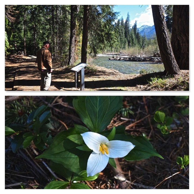 The trail at Silver Falls offers a nice way to explore the dry side of the Cascades for all hikers. Photo collage by trip reporter Bob and Barb.
With a flat grade and plenty of benches and signs, this trail makes for a calming outing through a beautiful area, no matter the occasion. In spring this can have trees down across the trail after a rough winter.
> Plan your hike on the Silver Falls Interpretive Trail using WTA's Hiking Guide
Wilson Creek Cottontail Trail
Location: Potholes Region
Mileage: 1.6 miles, roundtrip
Elevation Gain: 11 feet
Trail Type: paved
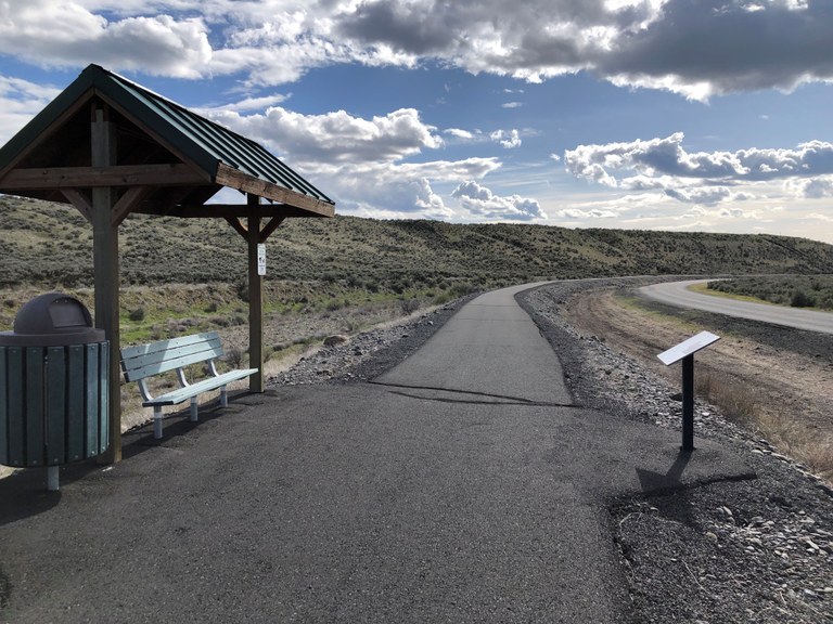
The paved Wilson Creek Cottontail trail is a wonderful place to enjoy the stark landscape of central Washington. Photo by Mary Hartman.
This paved trail outside the tiny town of Wilson Creek offers dramatic views of the surrounding area from a wide, paved trail. Benches and interpretive signs line the path, offering a glimpse into the history of the area.
> Plan your visit to the Wilson Creek Cottontail Trail using WTA's Hiking Guide

