Low Snow, High Peaks and Big Views: Summer's Coming to Washington
The long weekend inspired a lot of you to get outside. Trip reports show everything from backyard to backcountry, and a lot of you headed to some standby areas for adventure: the Mountain Loop Highway, Snoquera, and the Teanaway, part of WTA's Trails Rebooted campaign.
The long weekend inspired a lot of you to get outside. Trip reports show everything from backyard to backcountry, and a lot of you headed to some standby areas for adventure: the Mountain Loop Highway, Snoquera and the Teanaway. All these parts of Washington are in WTA's Trails Rebooted campaign, which encourages people to discover new-to-them trails and to be good stewards of Washington's trail system. It's exciting to see so many people heading out to these areas to visit old favorites and find new ones.
Of course the rest of Washington was pretty stunning, too. See where folks went and get inspired for the rest of the summer.
Jumpoff Joe Lookout
Region: Chinook Pass - Highway 410

Jumpoff Joe Lookout and vista. Photo by Hannah118.
If you can brave the bugs but crave views, this might be a good option for you. Take a chance and hike fast, and you might find the same thing Hannah118 did.
Elbo Creek
Region: Olympic Peninsula

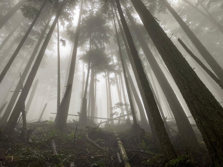
Foggy forest in Elbo Creek. Photo by twopaddles.
Unlike many hikes in Washington this weekend, Elbo Creek was foggy and cloudy, but that didn't detract from twopaddle's hike, where they saw some excellent, unusual saprophytes and the last of the season's rhododendrons.
Esmerelda Basin
Region: Salmon La Sac/Teanaway

Waterfalls and Jacobs Shooting Stars lighting up QAHiker's outing last weekend. Photo by QAHiker.
QAHiker found ideal conditions for this early-summer hike this weekend. Waterfalls, Jacobs shooting stars and many other flowers, and excellent views. Best of all, there's snow on the peaks but none on the trail!
Kettle Crest North
Region: Kettle Crest Range

Trail and horizon in Eastern Washington. Photo by HillSlug.
Despite having to cut their trip short because of a false alarm, HillSlug had an inspiring overnight on the Kettle Crest Trail. They saw just a few folks on their way out, and hope to return.
Coldwater Peak
Region: Mount St. Helens Area

St. Helens Lake, complete with log raft. Photo by Seattle-Amy.
Coming in via the just-opened Spirit Lake Highway, Seattle-Amy enjoyed wildflowers and views up the trail to Coldwater Peak, but notes to bring poles if you visit. A snowfield near the top is sticking around and footing might be tricky.
Mount Pilchuck
Region: Mountain Loop Highway

JoSilhouette and family at the Pilchuck lookout. Photo courtesy JoSilhouette.
Mom-to-be JoSilhouette summitted Pilchuck with her husband and 3-year-old and were lucky enough to get views after a foggy start. She reports a muddy trail from snowmelt but plenty is sticking around. Bring poles (per her recommendation) or give it a few weeks to melt all the way out.
McClellan Meadows
Region: South Cascades

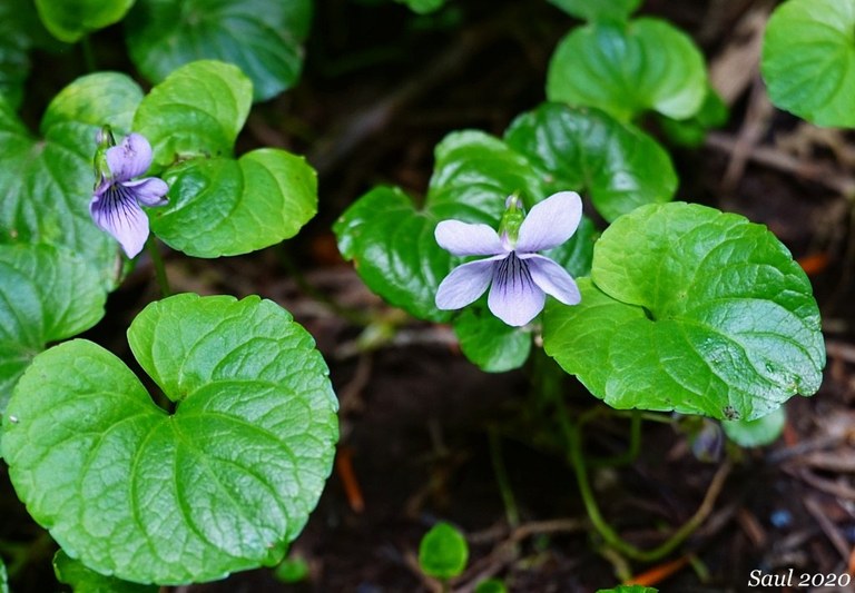
Marsh violets in McClellan Meadows. Photo by Susan Saul.
Sunrise Creek was seeking solitude and found it on this quiet, flower-filled trail in the Gifford Pinchot. Marsh violets, dogwood and columbine feature in the trip report, and even more flowers to be found in person.
Pasayten Loop
Region: Pasayten

Wild peaks of the Pasayten. Photo by porcupinewoman.
Part of WTA's Lost Trails Found campaign, the Pasayten is remote and wild, and as porcupinewoman reports, rarely snow-free. This trip sounds like a dream, and the report comes complete with a creative recipe for a backcountry salad!
May Valley Trail
Region: Issaquah Alps

Near the May Valley Trail. Photo by Eric Jain.
Geocacher Carlos made a short jaunt on this forested trail on Squak Mountain a bit of a longer hike in pursuit of a second cache. It was impromptu, but paid off!
Goat Peak
Region: Chinook Pass - Highway 410

Vista from the top of Goat Peak. Photo by visokoo.
Trip reporter visokoo had a few heart-rate-elevating moments on this steep, exposed trail. But they report that as long as you're sure footed (and packing poles for extra stability) the views from the top are totally worth it.
Spencer Island
Region: Seattle-Tacoma Area

Mama and baby seals at Spencer Island. Photo by Muledeer.
A mama and baby seal greeted Muledeer on this shoreline ramble outside of Everett. She noted the gorgeous seasonal greens, lots of wildlife and the inability to physically distance. Bring a face covering if you visit.
Lake Ann
Region: North Cascades Highway

Snowy Lake Ann last weekend. Photo by KelsMama.
KelsMama was happy to find a pass dispenser here when she realized she'd forgotten theirs at home. They took a short walk to this sweet little lake. Normally a pretty accessible hike, it's still quite snowy, so it's a bit of an adventure right now, but worth it.
Boardman Lake
Region: Mountain Loop Highway
 A very good boy at Boardman Lake. Photo by jeffdill.
Searching for a good training hike for his new 6-month old puppy, jeffdill decided on Boardman Lake. It was great in terms of length, though the road is rough and you'll want bug spray.
Mount Dickerman
Region: Mountain Loop Highway

At the top of Mount Dickerman. Photo by dmkr.
Kai revisited this Mountain Loop summit with his dad and dad's friend. Despite some snow to navigate on the way up, they were able to find a dry spot to hang out for lunch (ramen, yum!) before heading down.
Palisades
Region: Chinook Pass - Highway 410

View from Desdemona's hike in the Snoquera area. Photo by Desdemona.
This long loop hit the sweet spot of a snow-free, uncrowded loop for trip reporter Desdemona. It's close to 15 miles, and perfect for a long day hike.
Lewis Butte
Region: Methow/Sawtooth

Views from Lewis Butte. Photo by dluenberg.
This short, well-maintained trail in the Methow Valley offered dluenberg some nice views and big skies.


Comments