
Bandera Mountain is a chameleon. Most would describe it as an easy hike — relatively short and not very steep for most of its length — but then it suddenly changes, turning informal and rough, particularly in its last half mile, making it feel like the rugged backcountry trek it at times can be.
Start out on the Ira Spring Trail. The parking lot will likely be full if you come here on a nice weekend day. Not only is Bandera a popular hike, but it shares a trailhead with the equally popular trails to Mason Lake and Mount Defiance. For the first mile and a half, it is gentle and wide as it follows an old road bed. At about 0.8 mile from the trailhead, the trail reaches Mason Creek, a water crossing that used to be somewhat difficult during times of heavy runoff. Luckily, thanks to the efforts of volunteer crews and the generosity of the Spring Trust for Trails, a sturdy footbridge was installed across the creek in 2016, and hikers can safely cross it in all seasons.
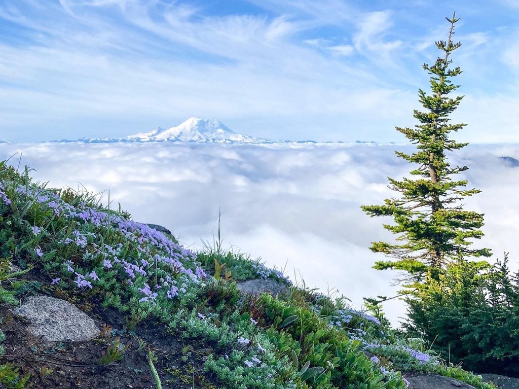
Past the bridge, the trail departs the old road and heads more steeply uphill. Occasional breaks in the trees enable partial views of Rainier to the south.
In another mile and a quarter, after a series of looping switchbacks, the trail to Bandera and the trail to Mason Lake part company as the way to Bandera heads straight uphill through a meadow of beargrass and bleached stumps of trees burned in a fire long ago. The next fifth of a mile is steep — in fact, one of the steepest stretches of trail you’ll find, gaining one foot of elevation for every two feet it travels. The saving grace for those not used to this sort of climbing is that it is mercifully brief and boasts firm footing in the form of numerous rocks and boulders.
The trail soon reaches a ridge and heads east along it. At times, it becomes somewhat difficult to follow as it enters minor rock fields, until reaching Little Bandera, technically a false summit. The vast majority of people turn around here after pausing to picnic among the blocky granite and stunted firs. There is nothing false about the views — this spot provides an excellent vantage of the ridge and meadows to the south, as well as across I-90 to nearby peaks like McClellan Butte and the ubiquitous Rainier. Turning around here gives you a roundtrip hike of 7 miles, with about 2,850 feet of elevation gain; perfectly respectable for a day hike.
If you must press on to the true summit, know that the trail gets hard to follow. It drops steeply over the rocks of Little Bandera’s summit and is barely visible. You'll lose and then regain elevation as you follow the ridge. Few people venture out this far — Bandera Mountain's actual summit is forested and holds no real attraction save for the glory of reaching a summit less than 100 feet taller than the false summit you just stood on.
Bandera Mountain

-
 Length
- 8.0 miles, roundtrip
-
 Elevation Gain
- 3,400 feet
-
 Highest Point
- 5,240 feet
FR 9030 is closed for the winter season.
Parking Pass/Entry Fee
Northwest Forest Pass
There are two sides to Bandera Mountain — gentle and well-groomed on the one hand, rough and untamed on the other. Together, they make for a very satisfying hike along a rocky ridge to a false summit (Little Bandera) with views impressive enough to dissuade most from completing the final half mile of informal trail to the "real" summit.
Continue reading
Hiking Bandera Mountain
Bandera Mountain
Map & Directions
 Trailhead
Before You Go
FR 9030 is closed for the winter season.
Parking Pass/Entry Fee
Northwest Forest PassWTA Pro Tip: Save a copy of our directions before you leave! App-based driving directions aren't always accurate and data connections may be unreliable as you drive to the trailhead.


