20 Hikes for the Best Berry Picking
Blueberries, salmonberries, thimbleberries, huckleberries...the Pacific Northwest has an abundance of edible berries to sweeten your late summer and early fall trail traipsing. Check out our berry-picking tips below, and get inspired with our list of 20 perfect hikes for seeking out a mouthful of berry bliss on trail.

(l to r) Huckleberries (and the similar-looking blueberries) are some of the most recognizable, and yummy berries on trail. Salmonberries can be yellow or orange, but later in the season go to a deep red. Thimbleberries are vividly colored, and intensely flavored. Photos by Kayla Hass, Alan Gibbs, and from WTA archives.
distinguishing between berries
- Huckleberries: Ranging in color from black to purple to red, ripe huckleberries offer a burst of tart flavor. While the flowers, seeds and fruit of huckleberries look mighty similar to blueberries, only a single berry is produced where the flower meets the stem.
- Blueberries: As their name implies, these berries tend to be reliably blue — though sometimes they'll show some purplish hues. They differ from huckleberries in that they grow in clusters on bushes from the previous years' growth.
Both huckleberries and blueberries can grow in either shade or sun, but for prime picking, stick to the meadows or lake shores that get a lot of sunlight: Sunny slopes with southern exposures are particularly good spots for both berry types.
- Thimbleberries: Similar to a raspberry in color, thimbleberries are more delicate, and best to eat when they've turned from soft pink to bright red.
- Salmonberry: Like a blackberry but lighter in color, salmonberries range from deep yellow to blush orange, sometimes a blood-red late enough in the season.
If you're concerned about picking the right berry for your noshing needs, bring along a reference guide or invite an experienced berry-hunter to tag along. Never eat any wild plant unless you're certain it's edible.
berry-loving wildlife
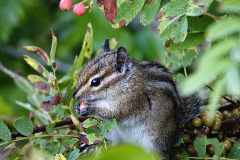
Hikers aren't the only ones who like to nosh on berries in the wild. Photo by geezerhiker.
Keep your eyes peeled for wildlife — berry fields are fantastic places to watch birds, who eat the berries and then spread the seeds far and wide, and offer one of your best chances of encountering a black bear in the wild. Learn what to do if you do encounter a bear.
Protecting your berry bounty (from getting squished)
A plastic baggie makes a fine container if you're not eating the berries right away and want the juicy flavor of berries for smoothies, sauces or as a drizzled ice cream topper (our personal favorite); the thin bags won't offer a ton of protection while storing. Alternatively, if you want to come home with intact berries for muffins, pies or pancakes, bring a hard-sided, lidded container — like a Nalgene bottle, bell jar or plastic Tupperware.
North Cascades
Shannon Ridge
Location: North Cascades - Mount Baker Area
Mileage: 8.2 miles, roundtrip
Elevation Gain: 2800 feet
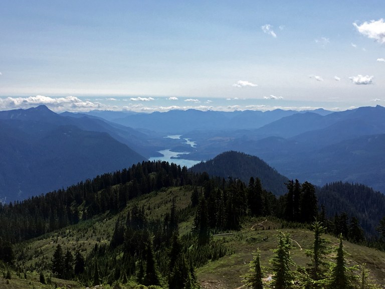
Berries are on their way along Shannon Ridge. in the meantime, the views of Baker Lake do not disappoint. Photo by Brad LaMar.
A peaceful trail in a popular area, Shannon Ridge offers a shady forest walk coupled with expansive views of the North Cascades once you attain the ridgeline. Also in abundance? Berries. Lots and lots of berries.
> Plan your visit to Shannon Ridge using WTA's Hiking Guide
Cutthroat Lakes via Walt Bailey Trail
Location: North Cascades - Mountain Loop Highway
Mileage: 10 miles, roundtrip
Elevation Gain: 2300 feet
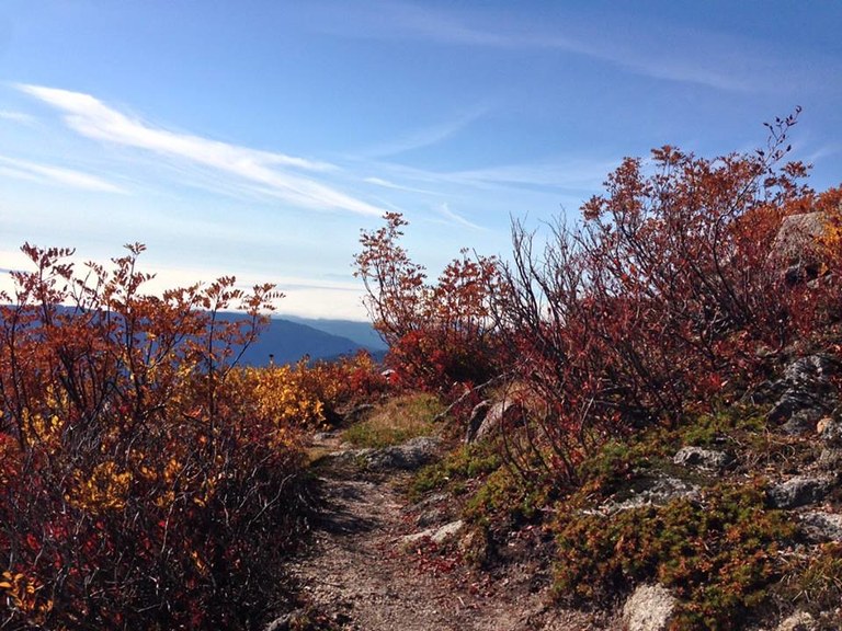
Berry bush remains along the Walt Bailey Trail in October. Photo by Liza Orengo.
Haven't heard of this trail? That's not a surprise — it's infrequently-visited due to it's distance off the more-frequently traveled Mountain Loop Highway. But now you know to go; the berries are bountiful near Cutthroat Lakes and on the flank of Bald Mountain. Bring a bucket with a lid for your harvest!
> Plan your visit to Cutthroat Lakes using WTA's Hiking Guide
Round Lake
Location: North Cascades - Mountain Loop Highway
Mileage: 11 miles, roundtrip
Elevation Gain: 4300 feet
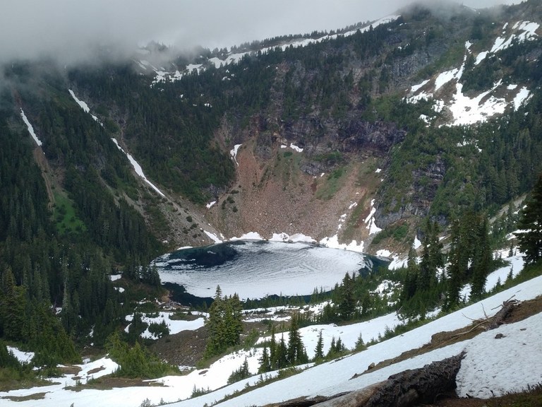
As winter approaches, you may have to content with snow, but that just means your berries get a little extra refrigeration. Photo by jdobbre.
Get a thigh-burning ridgerun in along Lost Creek Ridge to this little lake tucked down in a pocket of the ridge. It's a wild, rugged ramble accessing the North Fork Sauk River. While the way isn't particularly easy, the rewards are astounding views of the surrounding peaks, a hefty dose of solitude — and a harvest of berries that you will most likely only have to share with resident wildlife.
> Plan your Round Lake using WTA's Hiking Guide
Mount Dickerman
Location: North Cascades - Mountain Loop Highway
Mileage: 8.2 miles, roundtrip
Elevation Gain: 3950 feet
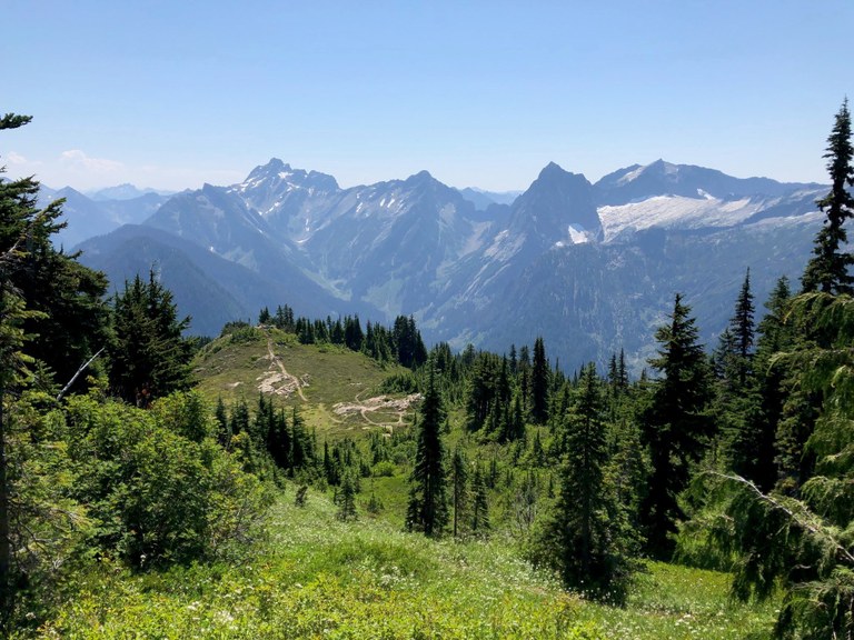
If the abundant berries can't entice you up the rugged Mount Dickerman Trail, perhaps the views will. Photo by Tree Hugger.
This is a challenging route to huckleberry heaven: Reaching the summit means almost 8.5 miles Mileage and over 3900 feet of elevation gain, but your reward will be ample. The views from up top are incredible - and the berries aren't bad either. Don't feel like making the full trek? No worries — the berry patches begin about two miles into the hike.
> Plan your visit to Mount Dickerman using WTA's Hiking Guide
Olympics
North Fork Skokomish River and Flapjack Lakes
Location: Olympic Peninsula - Hood Canal
Mileage: 15.4 miles, roundtrip
Elevation Gain: 3050 feet
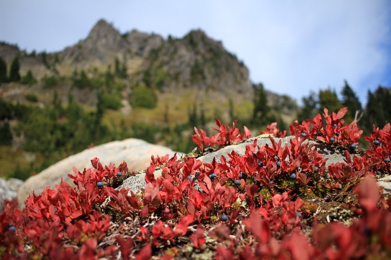
The berries (blue? huckle? you decide) are bountiful in the Olympics. Photo by Kyle Bachman.
This is a classic Olympic river hike with the option to climb into the sub-alpine splendor of a lake basin with views of the magnificent Sawtooth Range. If you're after berries, you'll need to climb up to Flapjack Lakes trail; mouthfuls of berries will be your reward.
> Plan your visit to the North Fork Skokomish using WTA's Hiking Guide
Bogachiel River
Location: Olympic Peninsula - Pacific Coast
Mileage: 12 miles, roundtrip
Elevation Gain: 400 feet
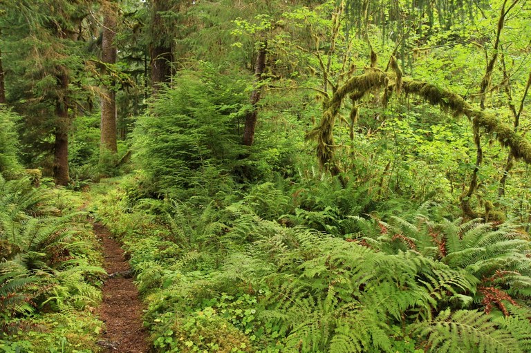
Bogachiel River. Photo by Birb.
A quiet riverside walk in Olympic National Park with reports of early-season berries that grow as big as the trees in the lushness of the rain forest. This trail makes a good walk later in the season, even if you don't get to snack along the way.
> Plan your visit to Bogachiel River using WTA's Hiking Guide
LaCrosse Basin
Location: Olympic Peninsula - Hood Canal
Mileage: 37 miles, roundtrip
Elevation Gain: 5588 feet
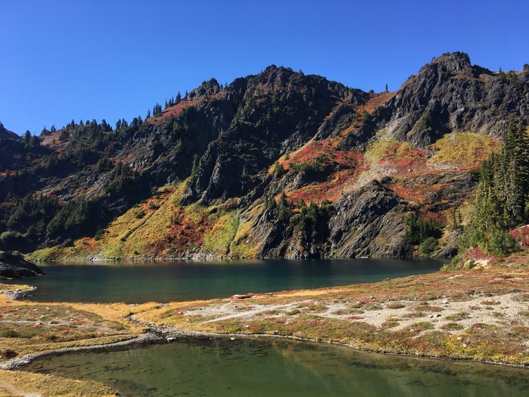
Easy to get to? No. Worth every moment? Absolutely. Photo by Kiloa.
Nestled deep in the heart of the Olympics, LaCrosse is not attained by the faint of heart. But thanks to a multi-faceted approach by several organizations (including some hardy WTA crew leaders and volunteers), the way to the plethora of berries available has been made easier.
> Plan your visit to Lacrosse Basin using WTA's Hiking Guide
Church Creek
Location: Olympic Peninsula - Olympia area
Mileage: 6.4 miles, roundtrip
Elevation Gain: 2300 feet

A sampling of the berries you'll find along Church Creek trail. Photo by Nutmeg.
With early-season salmonberries down low and huckleberries galore lining this out-of-the-way trail, Church Creek is a delight for collecting delectables. Wander among old-growth trees, mosses, lichens and ferns, and enjoy the many other rambles within easy reach.
> Plan your visit to Church Creek using WTA's Hiking Guide
Central Cascades
Tonga Ridge / Mount Sawyer
Location: Stevens Pass - West
Mileage: 8 miles, roundtrip
Elevation Gain: 1200 feet
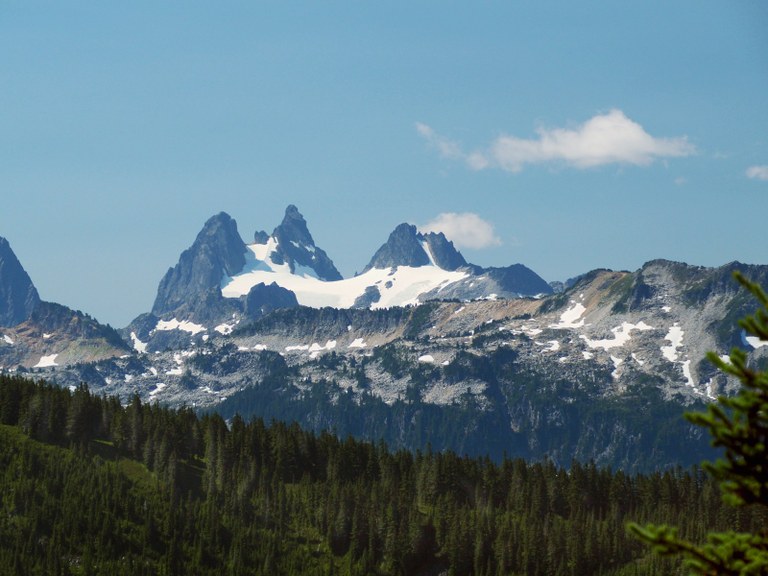
Eat the berries, gain the fuel. Photo by thebrink.
If you don't mind sharing your huckleberry fields with lots of other hungry hikers, head to Tonga Ridge: The views are stunning and the meadows beautiful. After a mile or so of hiking start looking down in the bushes for the fat, juicy berries. Feast here, or keep hiking another two miles to the meadow for the plumpest, juiciest ones.
> Plan your visit to Tonga Ridge using WTA's Hiking Guide
Thorp Mountain via Knox Creek
Location: Snoqualmie Region - Salmon La Sac/Teanaway
Mileage: 4.4 miles, roundtrip
Elevation Gain: 1734 feet
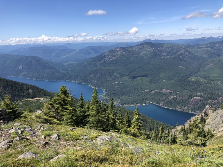
Wildflowers in early summer and berry fields in late, with spectacular views all year long. Photo by getoutside26.
Only one of several routes to the top of Thorp Mountain, Knox Creek offers the shortest route — which means (you guessed it) also one of the steepest. But not to worry: The fields of huckleberries begin a little after a mile into the hike.
> Plan your visit to Thorp Mountain using WTA's Hiking Guide
Pear Lake
Location: Central Cascades - Leavenworth area
Mileage: 12 miles, roundtrip
Elevation Gain: 2600 feet

Leftover summer berries get a light dusting of frost along the trail to Pear Lake. Photo by Must Hike Must Eat.
It's not just berries that should entice you to peruse Pear Lake: The trail also meanders through swaths of old-growth forest and wildflower-strewn meadows, and offers panoramic alpine views.
> Plan your visit to Pear Lake using WTA's Hiking Guide
Mount Catherine
Location: Snoqualmie Pass -- Snoqualmie Pass
Mileage: 3 miles, roundtrip
Elevation Gain: 1330 feet
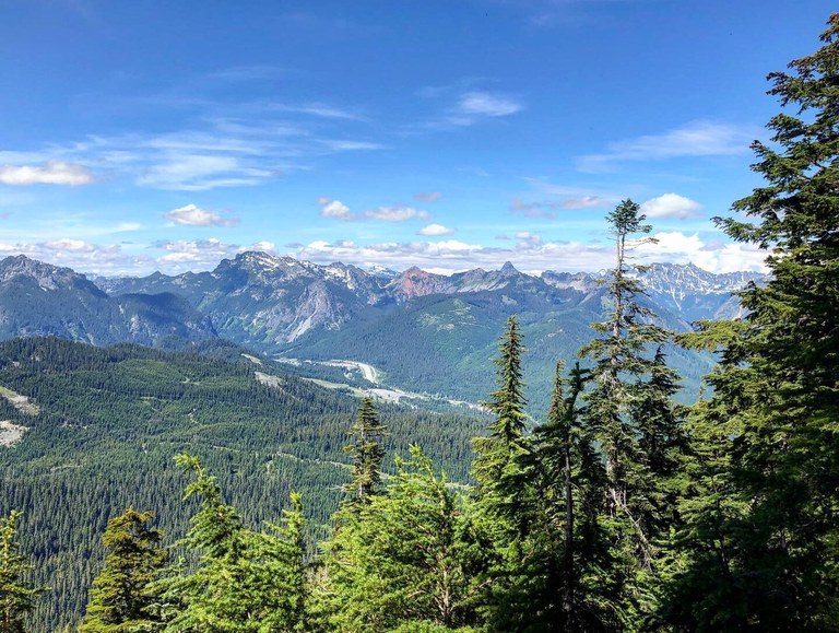
Whether you go for the berries or go for the views, Mount Catherine is unlikely to disappoint. Photo by Kristina's Kapers.
Once you find the trailhead (it's tricky, so read the directions and trip reports carefully), it's a remarkably short and easy hike to the summit of Mount Catherine — which boasts some amazing views. Along the way, feast on fields of berries that you may not have to share with a single other soul.
> Plan your visit to Mount Catherine using WTA's Hiking Guide
South Cascades and Southwest Washington
Naches Peak Loop
Location: Mount Rainier area - SE - Cayuse Pass/Steven's Canyon
Mileage: 3.2 miles, roundtrip
Elevation Gain: 600 feet
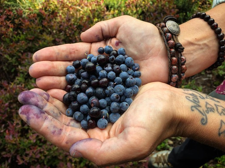
Bountiful berries in Mount Rainier National Park. Photo by Jim Clagett.
Experience divine hiking all the way into October on the Naches Peak Loop trail. It hosts some of the best views of Mount Rainier, along with late-blooming wildflowers and technicolor fall foliage. Go in September to find the huckleberries, but be prepared for company — black bears cruise for huckleberries, too!
> Plan your visit to Naches Peak Loop using WTA's Hiking Guide
Little Huckleberry Mountain
Location: Southwest WA - Columbia River Gorge
Mileage: 5 miles, roundtrip
Elevation Gain: 1800 feet
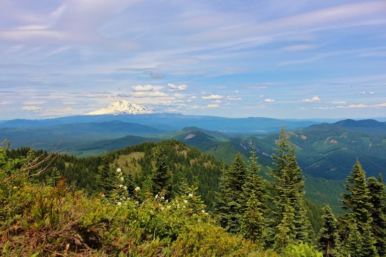
Big views — and an even bigger berry harvest — await atop Little Huckleberry Mountain. Photo by Elementalll.
A juicy little trail for Portlanders and Vancouverites! From bottom to top, this hike lives up to its name during a good berry year. It's a little dusty, but the juicy berries will keep you hydrated on a hot, late summer day. Small on trip reports, but big on berry harvests and abundant views.
> Plan your visit to Little Huckleberry Mountain using WTA's Hiking Guide
Butte Camp
Location: South Cascades - Mount St. Helens
Mileage: 8 miles, roundtrip
Elevation Gain: 1697 feet

Berries ripening along the trail to Butte Camp. Photo by The G's.
A relatively gentle trail that winds you through not just fields of huckleberries, but (at the right time of year) wild strawberries, as well. A perfect spot to muse on the burgeoning beauty that persists well after the destructive blast of St. Helens decimated the landscape.
> Plan your visit to Butte Camp using WTA's Hiking Guide
Bluff Mountain
Location: Southwest WA - Lewis River Region
Mileage: 12 miles, roundtrip
Elevation Gain: 890 feet

A pairing of berries and wildflowers is never remiss. Photo by bellaj1018.
The first 3 miles of this hike take place on an old roadbed — perfect for mountain biking, if you are so inclined. Adventurous folk can create any number of loops to extend the trip, or simply enjoy what will most likely be a quiet day of strolling and noshing along this relatively quiet stretch of trail.
> Plan your visit to Bluff Mountain using WTA's Hiking Guide
Eastern Washington
Salmo-Priest Loop
Location: Eastern Washington - Selkirk Range
Mileage: 19 miles, roundtrip
Elevation Gain: 3400 feet
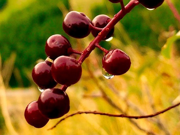
Late-season berries in eastern Washington. Photo by Jerrod Stafford.
Huckleberries are abundant on the high ridges and in the meadows along the Shedroof Divide on this remote backpacking loop in the northeastern-most corner of the state. If you like to feast on your huckleberries in solitude, this is the place for you. Do the whole loop in two or three days, or sprint up to the ridge for a great overnight trip with time to spare for your foraging delight.
> Plan your visit to the Salmo-Priest Loop using WTA's Hiking Guide
Mount Spokane State Park
Location: Eastern Washington - Spokane area
Mileage: varies
Elevation Gain: varies
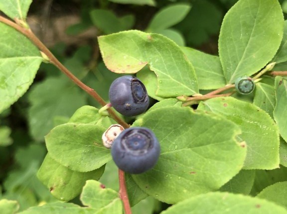
August means huckleberries on several trails in Mount Spokane State Park. Photo by TrailKat.
Mount Spokane State Park is a year-round recreational gem that boasts one of the inland Northwest's tallest peaks at 5,889 feet; it is also Washington's largest state park. While it is best known for its winter recreation, Mount Spokane's trail system is also a great spot to get your hands on some huckleberries.
> Plan your visit to Mount Spokane using WTA's Hiking Guide
Panjab Trail
Mileage: 5.6 miles, one way

Views galore, with some berries to boot, along the Panjab trail. Photo by markweth.
Note: The Panjab trail is currently difficult to hike as the bridge has been removed for the winter season. Access to the trail is available via the Rattlesnake Trail #3129, Packers Trail #3129 and the Mt. Misery Trail #3113; but not the Panjab Trailhead.
Often used as a starting point for those seeking long day rambles or overnight excursions, Panjab offers hikers and horseback riders an opportunity to nosh on early-season berries while admiring the extensive Blue Mountains views.
> Plan your visit to the Panjab Trail using WTA's Hiking Guide
Kettle Crest South
Mileage: 5 miles, roundtrip

A reliable harvest of ripe huckleberries along the Kettle Crest South trail. Photo by whitsaboutya.
This short southern section of the Kettle Crest National Recreation Trail is not only home to abundant berry bushes, but ample wildlife, as well: Coyotes, grouse, black bears, songbirds, mule deer and even the elusive lynx call this place home.

