Halfway Hikes: Kid-Friendly Turnaround Points on Longer Trails
If you're dragging along a reluctant partner, child or friend along on a hike, you've heard this a lot. You may even have said it to yourself on a solo outing, hoping you have crept closer to your destination the next time you check your map.
Sometimes in these situations, it becomes clear you're not gonna make it to the end of the trail. But when that happens, having a nice place to rest, have a snack, and turn around can make it feel more like you arrived at a destination.
So we compiled a list of several trails with nice spots along the trail to rest or call it a day. (And, if you and your crew are having a great day, you can of course keep going!)
Read on for some old favorites, or new locations. A lot of these are lakes, but not all of them.
Snoqualmie Region
Pratt Connector View (Pratt Connector trail)
Location: North Bend Area
Length: 2.6 miles, roundtrip
Elevation Gain: 80 feet
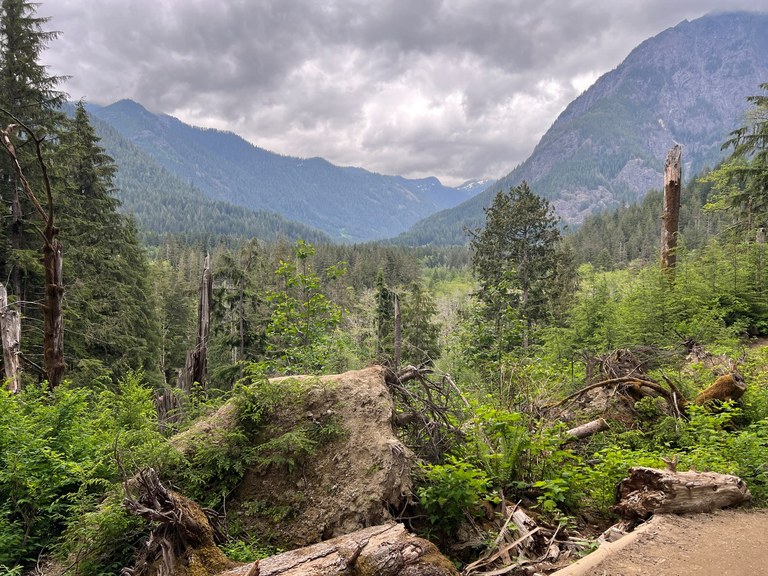
The upvalley views from the Pratt Connector Trail are magnificent when there's a break in the trees. Photo by trip reporter girl with dog.
Just under a mile southwest of the Middle Fork trailhead is one of the more spectacular views of the Middle Fork Valley. Simply hike to a sharp switchback (about 0.8 miles) and turn around. The view features looming mountains and a crashing river, all made possible because of a fortuitous break in the tree cover.
> Plan your hike to this view using WTA's Hiking Guide
Mason Lake (Mount Defiance)
Location: Snoqualmie Pass
Length: 5.80 miles, roundtrip
Elevation Gain: 2,637 feet
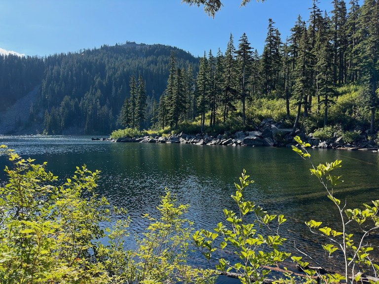
Mason Lake is a great destination in its own right, or as a turnaround point on a hike originally planned to be longer. Photo by OutdoorAl.
Well-known in its own right, Mason Lake is a popular backcountry camping area. But it's also a delightful stopping point along the way to Mount Defiance. With lakeside day use areas, this little lake is a great stopping spot after a decent amount of elevation gain.
> Plan your hike to Mason Lake using WTA's Hiking Guide
Riverside Sittin' Spot (Copper River)
Location: Salmon Le Sac/Teanaway
Length: 2.0 miles, roundtrip
Elevation Gain: 888 feet

The Cooper River trail has plenty of riverside spots where one can rest, or watch other people pursuing some wild river-centric activities. Photo by trip reporter kaeldra.
The Copper River Trail is a lovely, chill hike that ambles alongside the Copper River all the way to Owhi Campground, Pete Lake and beyond. But just 2 miles in is a lovely little sitting spot that's quiet and peaceful. If your crew doesn't want to go quite that far, there's a pretty great swimming hole about 50 feet down the trail from the parking area!
> Plan your hike to the Copper River trail with WTA's Hiking Guide
Central Cascades
Trout Lake (West Fork Foss River and Lakes)
Location: Stevens Pass - West
Length: 3.2 miles, roundtrip
Elevation Gain: 500 feet

There's even a huge Douglas-fir at Trout Lake that makes for a great touch with nature for kids. Photo by trip reporter CuatroDeMayo.
The West Fork Foss Trail features several gorgeous little lakes, but some take quite some work to arrive at. If you want a shorter walk in the woods, try stopping at Trout Lake. Bonus points: it has a campsite, so there are plenty of places to relax near the lake or further back in the woods.
> Plan your hike to Trout Lake using WTA's Hiking Guide.
PCT North Junction (Lake Valhalla via Smithbrook Trailhead)
Location: Stevens Pass - East
Length: 2.42 miles, roundtrip
Elevation Gain: 770 feet
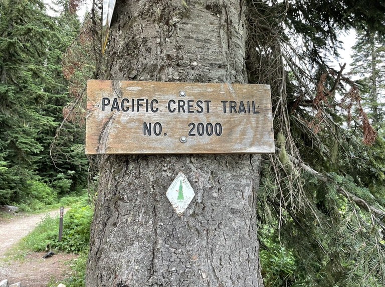
Hang out at Union Gap in late summer and you may see some PCT thru hikers on their way to Canada. Photo by trip reporter LukeOut.
From the Smithbrook trailhead, it's a small climb and just over a mile to the junction of this trail with the PCT at Union Gap. In late summer, you're likely to see PCT thru-hikers. Bring a snack and sit at the junction; they're often just coming off a break at the pass but you may have some luck chatting with a few as they make their final push to Canada!
> Plan your hike to the PCT North Junction using WTA's Hiking Guide
Creekside dabbling (Icicle Ridge via Fourth of July)
Location: Leavenworth area
Length: 0.98 miles, roundtrip
Elevation Gain: 315 feet
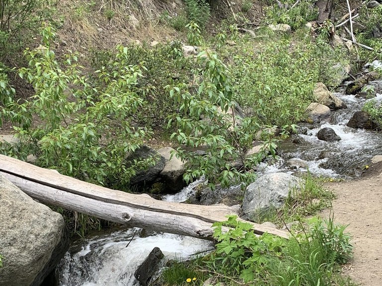
The hike up Icicle Ridge is quite steep, but there are several creek crossings at the beginning that are nice sitting spots. Photo by trip reporter Shart Attack.
The hike up Icicle Ridge is a burner, but luckily, there are two creek crossings in the first, mercifully gentle half-mile. These are great for sitting and playing a while. Plus if you want a little more trail time, the Icicle Gorge Loop trail nearby offers a wonderful creekside ramble.
> Plan your hike to Icicle Ridge via Fourth of July
North Cascades
Lake Metan (Mount Pugh)
Location: Mountain Loop Highway
Length: 3.38 miles, roundtrip
Elevation Gain: 1,390 feet
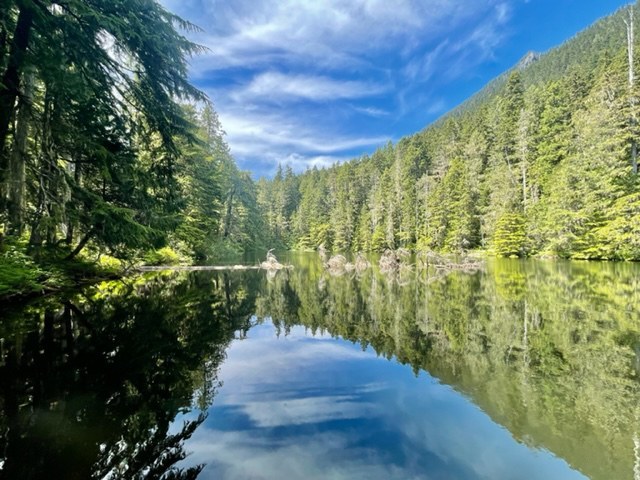
Lake Metan is a fantastic stopping spot on the way up Mount Pugh if you want to avoid the exposed sections of the trail. Photo by mlervick.
Mount Pugh is one of the steepest and most exposed trails in the North Cascades, but a bit more than a mile up this trail is a quiet little lake with a nice view of Stujack Pass. It's a good first trip to take with kids who are ready to start a bit more climbing without doing the exposed section.
> Plan your hike to Lake Metan using WTA's Hiking Guide
Beaverplant Lake (Ashland Lakes)
Location: Mountain Loop Highway
Length: 3 miles, roundtrip
Elevation Gain: 473 feet

Beaverplant lake has campsites and a nice boardwalk out towards the center of the lake, depending on what kind of vibe you want. Photo by trip reporter Mike Parry.
The Ashland Lakes trail used to be accessed via a truly awful road, but after road work in 2023, the road has improved, and the trail is great too, thanks in park to WTA volunteer crews! And while it's named for the destination lakes, the trail's peak is actually at scenic Beaver Plant Lake, which also feature a boardwalk to a lakeside overlook.
> Plan your hike to Beaverplant Lake using WTA's Hiking Guide
Foggy Dew Falls (Sunrise Lake)
Location: Methow/Sawtooth
Length: 3.16 miles, roundtrip
Elevation Gain: 946 feet
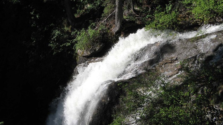
Foggy Dew Falls is a gorgeous landmark early on in the Foggy Dew Trail. Photo by trip report Rolan.
Sunrise Lake is a spectacular destination but there's a fantastic overlook of Foggy Dew Falls a little more than a mile into the trail. And even before then is a small side trail to the creek where you can refill water, or just call it a day there!
> Plan your hike to Foggy Dew Falls using WTA's Hiking Guide
South Cascades
Cathedral Falls (Goat Creek Loop)
Location: Cowlitz Valley/White Pass
Length: 1.68 miles, roundtrip
Elevation Gain: 544 feet
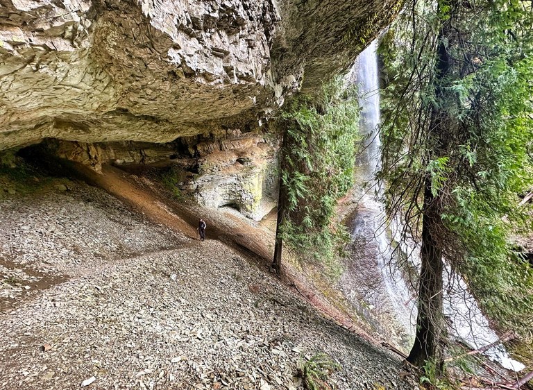
Cathedral Falls is a wonderful landmark on the Goat Creek trail towards the beginning; great for kids getting started hiking. Photo by rkjenner.
Cathedral Falls is a truly stunning waterfall less than a mile from the Goat Creek trailhead. The trail goes behind it, which is a joy for hikers of all ages. In late summer, the water may run thin, but in early season it can be quite remarkable.
> Plan your hike to Cathedral Falls using WTA's Hiking Guide
Blankenship Meadows (Blankenship Lake)
Location: White Pass/Cowlitz River Valley
Length: 4.8 miles, roundtrip
Elevation Gain: 1,079 feet
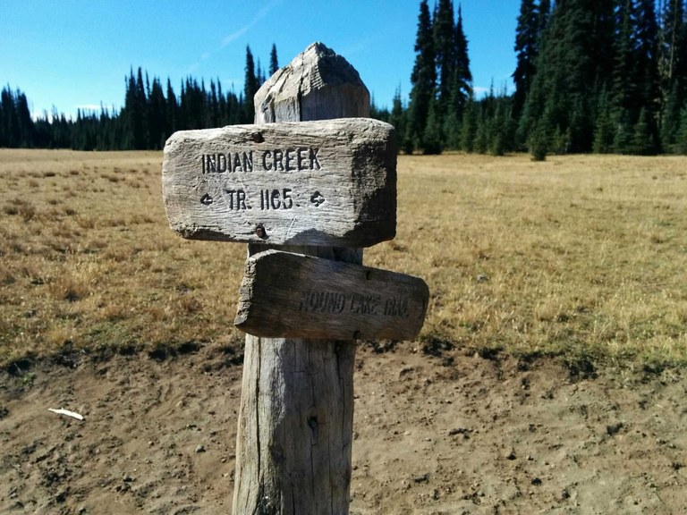
The trail to Blankeship Lakes passes through the interesting (and somewhat eerie) Blankenship Meadows. Photo by Loren Drummond.
This trail is a great option to hike the whole way, but if your group needs to call it quits before then, head for the meadows before the lakes. They have a huge view of the sky, a long treeline, and in fall offer a quiet area free of bugs!
> Plan your hike to Blankenship Meadows using WTA's Hiking Guide
Ginnette Lake and Hell Lake (Shoe Lake)
Location: White Pass/Cowlitz River Valley
Length: 3.86 miles, roundtrip
Elevation Gain: 1,020 feet
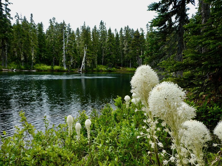
Ginnette Lake is the first of two sweet little lakes on the first mile of the PCT from White Pass. Photo by Birdman.
These two sweet little lakes are a little more than a mile from the trailhead of the Pacific Crest Trail South. It's a low-key, nicely-graded hike to some calm lakes that are perfect for resting and exploring the area. The data listed for this suggestion is for Ginnette Lake, but if you want to continue just another quarter mile you'll arrive at an overlook of Hell Lake.
> Plan your hike to Ginnette and Hell Lakes using WTA's Hiking Guide
Olympic Peninsula
Lillian Ridge (Obstruction point)
Location: Northern Coast
Length: 4.0 miles, roundtrip
Elevation Gain: 200 feet
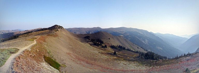
The trail at Lillian Ridge offers views for miles essentially straight from the trailhead. Photo by trip report wenguin.
Views start from the trailhead at Obstruction Point and just get better with every step. The full 2 miles out to Lillian Ridge does have spectacular views, but take care that you don't start heading down to Grand Valley - it's a long way back uphill!
> Plan your hike to Lillian Ridge using WTA's HIking Guide
Sink Lake (Mount Townsend)
Location: Hood Canal
Length: 0.64 miles, roundtrip
Elevation Gain: 203 feet
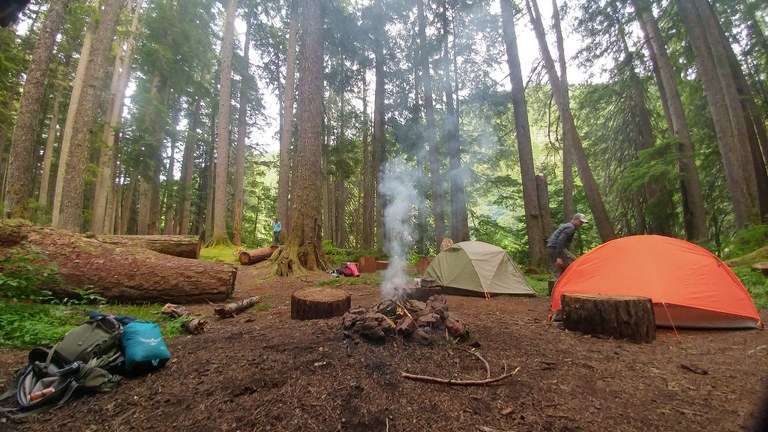
A campsite between the Lower and Upper Mount Townsend trailheads is an unexpected stopping spot on your way to the top. Photo by Matthew Pahs.
Try this little hack on one of the most popular trails on the Olympic Peninsula -- start hiking Mount Townsend from the lower trailhead to pass Sink Lake. It's a very short distance to Sink Lake and if your group wants to continue, it's about a two and a half miles to Windy Camp, another nice stopping point.
> Plan your hike to Sink Lake using WTA's Hiking Guide
Wolf Bar (North Fork Quinault River and Halfway House)
Location: Pacific Coast
Length: 4.92 miles, roundtrip
Elevation Gain: 659 feet
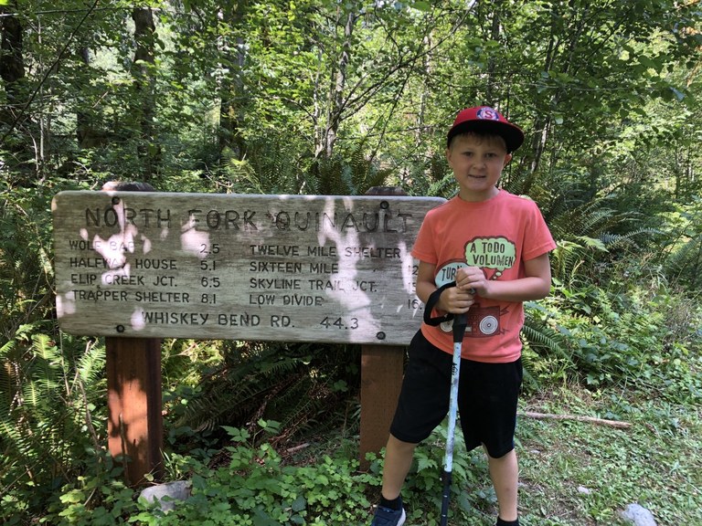
The North Fork trail is kid-approved for interesting trailside sightings. Photo by wgarrow.
The relatively flat trail along the North Fork Quinault Trail is awesome for rambling for miles. But a good destination is Wolf Bar, just over two miles from the trailhead. It's the first good view of the river, and it's kid-approved as a destination!
> Plan your hike to Wolf Bar using WTA's Hiking Guide
Eastern Washington
Emerald Lake (via Hoodoo Canyon)
Location: Okanogan Highlands/Kettle River Range
Length: 5.0 miles, roundtrip
Elevation Gain: 300 feet
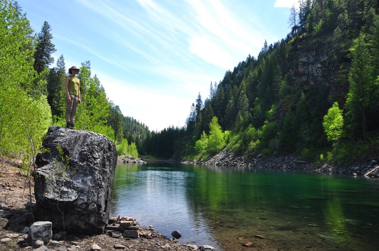
Emerald Lake is a great rest spot on the Trout Lake trail. Photo by trip reporter just peachy.
Emerald Lake sits at the center of a trail with two different trailheads. The shorter approach is a great one for families, at just 2.5 miles from the trailhead. Views are available before you get to the lake itself, but there's nothing like a lakeside lunch.
> Plan your hike to Emerald Lake using WTA's Hiking Guide
View of Little Spokane River (knothead loop)
Location: Spokane/Coeur D'Alene Area
Length: 1.96 miles, roundtrip
Elevation Gain: 321 feet

The view from the top of the Knothead Loop is gorgeous, especially on a clear day. Photo by trip reporter California Girl.
This lovely little hike was largely built by WTA volunteers. The overlook of the Little Spokane River requires just a small climb to a view (above). There are several other viewpoints in this area, but the first one is less than a mile and a half from the trailhead. There's also a great location along the Little Spokane River itself where you can sit riverside without doing the climb.
> Plan your hike to the view of the Little Spokane River using WTA's Hiking Guide
Wildlife Blind (McDowell Marsh Environmental Trail)
Location: Selkirk Range
Length: 0.92 miles, roundtrip
Elevation Gain: 29 feet
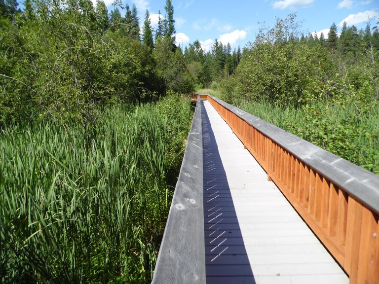
The McDowell boardwalk loop is a great early hike for families just getting into it. Photo by trip reporter Dan Price.
This wheelchair-friendly loop is also kid-friendly, and it's so short most kids can probably handle the whole thing. But if you want a break, there's a wildlife blind you can stop at about a half mile from the trailhead. Enjoy it!
> Plan your hike to the McDowell Marsh Environmental Trail using WTA's Hiking Guide

