WTA's Dark Places Digest
When a meteor shower falls on a weeknight, it can be hard to think of a place far enough away from light pollution that you can see celestial activity but still be home in time for work the next day. Here are some places where you can see a shooting star without planning a backpacking trip.
(If you can spend the night or are willing to wake up super early, we included a few state park locations on this list with camping options.)
Here are some special considerations for being outside at night.
- See in the dark: Bring a headlamp or a flashlight for each person in your group. Save your eyes (and your companions) from light blindness by using the red setting on your headlamp or flashlight. Don't have a red light? Just tape some red plastic wrap over the light.
- Stay found: Go somewhere you feel comfortable navigating in the dark.
- Share your plans: Let someone know your itinerary. Tell your contact where you're going, how long you plan to be gone, and what time you'll be back.
- Bundle up: Dress warmly and bring blankets.
- Step lightly: As in the daytime, be sensitive to vegetation. Set up your watch spot (blankets, chairs, etc) on hard packed dirt, rocks, snow or durable surfaces, never in meadows or on fragile plants. (Some alpine vegetation can take many years to recover from disturbances.)
- Document it: Brush up on your nighttime photography skills.
Central Washington
Steamboat Rock State Park
Location: Grand Coulee
Length: 6.0 miles, roundtrip
Elevation Gain: 650 feet

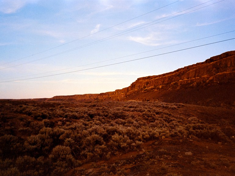
The views from the top of Steamboat Rock are incredible. The night sky is even better. Photo by trip reporter KristenSF.
The starry skies at Steamboat Rock are absolutely astounding. If you can, make this one an overnight; the stars here are some of the brightest in the state, and the sounds of a desert at night are hypnotically relaxing. In case this is a longer drive for you, double-check that you have everything you might want for the evening, including a Discover Pass.
> Plan your trip to Steamboat Rock State Park using WTA's Hiking Guide
Cascade Park - Wenas WIldlife Area
Location: Yakima
Length: 2.0 miles, roundtrip
Elevation Gain: 1250 feet

Cascade Park is dramatic, and great for star viewing when it's not cloudy! Photo by Holly Weiler.
A popular camping and birding spot, this area is best known for its free (with Discover Pass) camping. There are no official trails here, just a few old roads, but as a place to camp and enjoy the stars, this one is hard to beat. Try to arrive before dark, and if you arrive after sunset, be sure to be respectful of other campers if you are using your headlights.
> Plan your trip to Cascade Park using WTA's Hiking Guide
Sun Lakes-Dry Falls State Park
Location: Grand Coulee
Length: varies
Elevation Gain: varies
 Sun Lakes - Dry Falls State Park has great big skies and a lot of miles of trail, but you can see the night sky right off the highway. Photo by Whitaker Reid.
Really, all you need to do to catch amazing stars from here is stop at the overlook. There are many miles of trails to explore, but you'll get a good view right from the parking area. If you want to stay the night and tromp the trails, get a spot in the campground, about a quarter-mile and a few hundred feet lower than the overlook.
> Plan your visit to Sun Lakes - Dry Falls State Park with WTA's Hiking Guide
Puget Sound and Snoqualmie Area
Snoqualmie Valley Trail
Location: North Bend
Length: 32.0 miles, one-way

The Snoqualmie Valley Trail has multiple access points and plenty of views of the sky for meteor shower viewing. Photo by trip reporter ToniLyn.
The 32-mile Snoqualmie Valley Trail winds through the Snoqualmie Valley and has multiple access points. Though many sections traverse through a tunnel of trees, there are some spots with great views of the sky, including Taylor's Landing and just east of North Bend. The 356th Pl SE access to this trailhead is a wheelchair-friendly lot!
> Plan your hike to the Snoqualmie Valley Trail
Mount Constitution
Location: San Juan Islands
Length: 6.7 miles, roundtrip
Elevation Gain: 1500 feet

View from the summit of Mount Constitution. Photo by Lauren Leakey.
As the highest point on Orcas Island, Mount Constitution offers unparalleled views over Puget Sound. It's great for hikers of all abilities; gung-ho hikers can make the exhilarating push to the top, while more easy-going folks can drive to the summit. Because it's in a state park, hikers who want to take advantage of Mount Constitution as a night hike will have to camp, so be sure to have a Discover Pass and a campsite picked out. Of course, you can take off as early as you like if you've got to get to school or work.
> Plan your trip to Mount Constitution using WTA's Hiking Guide
Ebey's Landing
Location: Whidbey Island area
Length: 5.6 miles, roundtrip
Elevation Gain: 260 feet

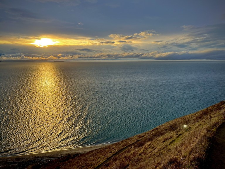
Clear views of the sky and water make Ebey's Landing a great place to watch the sunset or the stars. Photo by RKiser.
Ebey's Landing offers hikers the option of either hiking up to the top of the bluff for high-up views after a climb or hiking along the beach without making a climb. Make sure to park at the Prairie Overlook trailhead if going for some stargazing, as the Ebey's Landing trailhead closes at dusk.
> Plan your visit to Ebey's Landing using WTA's Hiking Guide
Southwest Washington
Goldendale observatory State Park
Location: Columbia River Gorge
Length: minimal
Elevation Gain: minimal

The observatory at Goldendale is an excellent spot to keep your eye on the sky. Photos: Bernt Rostad and Lijuan Guo
The observatory at Goldendale offers a fantastic place to get breathtaking views of the night sky. And the observatory is only a 20-minute drive along Highway 97 to Brooks Memorial State Park, which is both a great place to spend the day before heading to the observatory for some stargazing and a possible place to spend the night if you want to avoid driving too far after you're done with the stars. The campground has 45 campsites — just be sure to make a reservation to snag your spot!
The observatory is a popular location during celestial events, so be prepared to share the space with other star-lovers. All visitors to Goldendale now need to make a reservation on the state park website before arriving.
> Plan your trip to Goldendale Observatory State Park using WTA's Hiking Guide
Silver Lake
Location: Mount St. Helens
Length: 3.0 miles, roundtrip
Elevation Gain: 100 feet

The boardwalk over Silver Lake at Seaquest State Park is a great place to stargaze. Photo by Liz M.
The boardwalk of the Silver Lake trail at Seaquest State Park is flat with high guardrails, so it's ADA-accessible and perfect for kids. You'll zigzag out over the shallow waters of Silver Lake, and on clear, calm nights, you might even be able to see reflections of zooming comets in the still water around you. As with most state parks, Seaquest does close after dusk, but for those who don't want to reserve a campsite, it's possible to get a great view of the night sky by pulling off of highway 504 in a safe turnout and looking up.
> Plan your trip to Silver Lake using WTA's Hiking Guide
MaryHill State Park
Location: Columbia River Gorge - WA
Length: minimal
Elevation Gain: minimal

Maryhill State Park doesn't have many trails, but it does have a campground, a lot of sky, and not a lot of light pollution! Photo by trip reporter wakkf00.
Maryhill State Park is largely a camping area and boat launch, but it also has great open skies for stargazing. Near The Dalles and just 25 minutes from Goldendale Observatory, it's a great spot to take in the night sky.
If you can't secure a campsite, head up the hill to Maryhill Art Museum on the bluff. While it won't be open at night, it offers a nice view across the river, and even more expansive skies.
> Plan your visit to Maryhill State Park and Stonehenge with WTA's Hiking Guide.
Olympic Peninsula
Kalaloch - Third Beach
Location: Pacific Coast
Length: 3.6 miles, roundtrip
Elevation Gain: 280 feet

Third Beach at sunset - hikers will want to bring headlamps to navigate if visiting at night. Photo by trip reporter jeffdill.
Meteor showers on the Olympic Peninsula are an otherworldly spectacle. Plus, the hike in is minimal — the beach is about 100 feet from where you park your car, and the west coast of the Olympic Peninsula is a great spot to avoid light pollution. The ocean can be unpredictable at any hour of the day or night, so grab a tide table before heading out, keep little ones close at hand, and be aware of waves and crashing surf.
> Plan your trip to Third Beach using WTA's Hiking Guide
Dungeness Recreation Area
Location: Northern Coast
Length: 3.0 miles of trails
Elevation Gain: minimal

Walking along the beach at Dungeness Recreation area. Photo by trip reporter WalkieTalkie.
Situated on the bluff above the Strait of Juan de Fuca, this area boasts 67 campsites in addition to the scenic, mile-long bluff trail and excellent birdwatching. This park is managed by Clallam County Parks. There is no fee for day use, but you must reserve and pay to stay in a campground overnight. Amenities include hiker/biker sites, ADA-accessible restrooms and showers.
> Plan your trip to Dungeness Recreation Area using WTA's Hiking Guide
Illahee State Park
Location: Kitsap Peninsula
Length: 0.5 miles of trail
Elevation Gain: minimal

Illahee State Park beach. Photo by trip reporter cathartes.
This is a great destination for a family overnight. Because the trail is 0.5 mile, everyone will be able to enjoy a nice walk with plenty of time to stop along the beach or at the playground. Reserve one of the 23 campsites ahead of time. If you're just visiting for the day, you will need a Discover Pass to park in the parking area. If you're visiting without a car and plan to camp, there are two hiker/biker sites. The park has all the amenities, including ADA-accessible restrooms and showers.
> Plan your trip to Illahee State Park using WTA's Hiking Guide
Northwest Washington
Rasar State Park
Location: Highway 20
Length: varied
Elevation Gain: varies
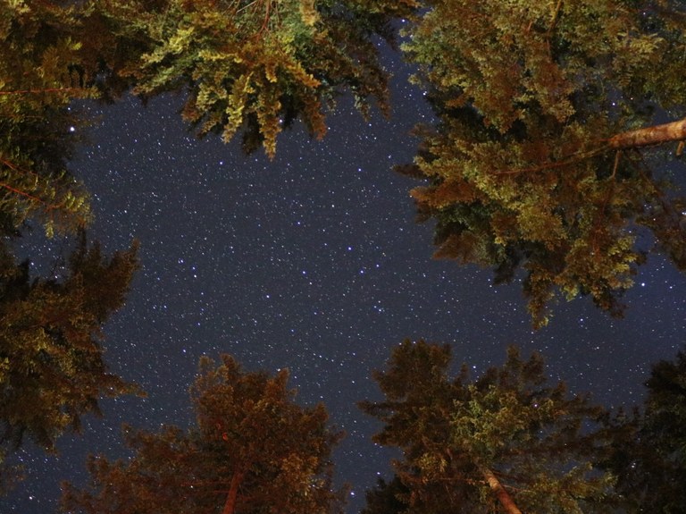
 Rasar State Park night sky and lit up trees. Photo from WTA archives.
Rasar State Park has many miles of trails to explore (including a one-mile wheelchair-friendly trail), a campground, and river access. While the campground has a fair amount of tree cover, you can still spot quite a few stars, even if you've got a little light pollution at your site.
> Plan your visit to Rasar State Park with WTA's Hiking Guide
Artist Ridge - Huntoon Point
Location: Mount Baker Area
Length: 1.2 miles, roundtrip
Elevation Gain: 200 feet

Huntoon Point at dusk. Photo by Meg Carlson.
On summer days, Artist Point can fill up with hikers trying to make the most of summer in this alpine location. Evenings can be crowded too — the expansive skies and gorgeous views aren't exactly a secret — but with a vista like this, how could anyone resist? Because snow sticks around here for so long, it's possible that the summer trail won't be open for some early-season meteor showers. Be prepared if you plan to take the winter route, or better yet, hang out in the parking lot and make friends with your fellow celestial observers.
> Plan your trip to Artist Ridge - Huntoon Point using WTA's Hiking Guide
Samish Overlook
Location: Bellingham Area
Length: 6.5 miles, roundtrip
Elevation Gain: 1900 feet

Sun setting over the Strait of Juan De Fuca. Photo by trip reporter PNWExplorer.
You can't camp at Oyster Dome, but luckily, Samish Overlook offers views nearly as good as those from Oyster Dome itself. Go, snap some pics, and be back in time for bed. The trail to Oyster Dome has been improved recently, but it's steep, and there are lots of junctions with other trails. If you do decide to hike, go with a headlamp or a flashlight (one per person in your party) and take your time. Consult a map when you come to junctions to be sure you're on the right trail.
> Plan your trip to the Samish Overlook using WTA's Hiking Guide
Harts Pass
Location: Pasayten
Length: 28.8 miles, roundtrip
Elevation Gain:various

Harts Pass at dusk. Photo by trip reporter LghtChsr_MtnLvr.
The Pasayten is renowned for its hugely expansive views and relatively easy hikes to access them. Harts Pass is one of the easiest — you can drive to it! Once you're in the pass, you can pull off the road and wander onto the Pacific Crest Trail for a while, or simply step out of your car and look up.
The road to Hart's Pass can be a little nerve-wracking for people who haven't ventured that way before. Check road conditions before heading up the pass. Try giving it a test run in the daylight, and be sure to keep your eyes out for animals who might cross the road in front of your car.
> Plan your trip to Hart's Pass using WTA's Hiking Guide
Eastern Washington
Telford Recreation Area
Location: Spokane/Couer D'Alene
Length: varies
Elevation Gain: varies

The Telford Recreation Area may not have a ton of trails, but it's a nice spot to avoid light pollution, see artifacts, and spend a good night stargazing before heading home. Photo from WTA archives.
The Telford Recreation Area is just a bit outside Spokane with huge skies and the unusual case where a former burn works to advantage the visitor. Because it looks more like a moonscape now than a grassland, the area feels really ethereal during an evening of stargazing.
> Visit the Telford Recreation Area by planning with WTA's Hiking Guide
Odessa Craters
Location: Spokane/Coeur D'Alene
Mileage: 1.5 miles
Elevation Gain: 1783 feet

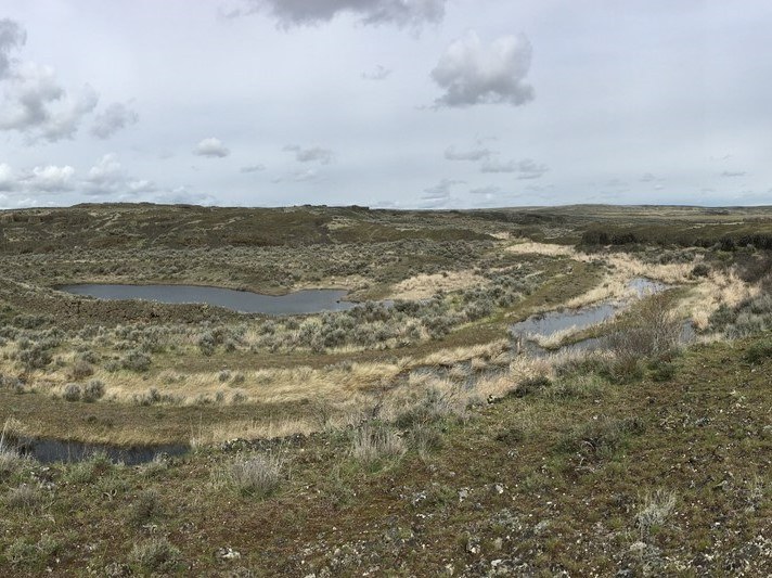
Odessa Crater on a spring day. Photo by trip reporter PNWstelladog.
Relics from the Missoula Floods, Odessa Craters is a wonderful short jaunt from Davenport (though a bit more of a drive from Spokane). Visitors don't even need to walk any of the trail to enjoy the stars here; just step out of your vehicle and look up. Do try to use a bathroom before you get here, though — there isn't one at the trailhead.
> Plan your visit to Odessa Craters using WTA's Hiking Guide
Palouse Falls
Location: Palouse/Blue Mountains
Length: minimal
Elevation Gain: minimal

Washington's state waterfall makes a majestic destination for night photography. However, it's worth noting that any access to the foot of the waterfall has been officially closed by the park, so plan on staying in the parking area and at the overlook for this one. That's okay. You'll get a LOT of great shots if you have the right gear.
> Plan your visit to Palouse Falls using WTA's Hiking Guide.
- Check out more locations: Didn't see a spot that works for you listed above? See what our Facebook community had to say about where they go to lie beneath the stars, or search our Hiking Guide for something near you.

