12 fun hikes for fall and spooky season, from Phantom Lake to Crooked Tree Trail
Fall is here — time for falling leaves, apples galore and all things spooky! If you’re looking to embrace autumn and with some outdoor time, check out some of these (particularly appropriate) hikes for this time of year.
Apple Capital Recreation Loop Trail
Location: Central Washington > Wenatchee
Length: 10 miles, roundtrip
Elevation gain: 600 feet

Golden colors coat the trail. Photo by ZhuckYu.
A few things we love: caramel apples, bobbing for apples and accessible trails in late fall and winter! This paved trail is great all year round for hikers, runners and bikers of all ages. The trail takes you along the Wenatchee and Columbia rivers, so it’s also a great place for a waterfront picnic on a warmer fall day.
> Plan your hike on the Apple Capital Recreation Loop Trail using WTA's Hiking Guide
Northern state ghost town
Location: North Cascades > North Cascades Highway – HWY 20
Length: 5.0 miles, roundtrip
Elevation gain: 50 feet

Abandoned barns at Northern State Ghost Town. Photo by trip reporter kokay.
Once the largest hospital for people with mental health conditions in Washington State, Northern State Mental Hospital was a town unto itself. Parts of the site are still in use and off-limits, but the farm is now a recreation area. It is located just north of the Skagit River near the town of Sedro-Woolley. Stroll along the wide pastoral trails amongst the buildings and cemetery.
> Plan your hike on the Northern State Ghost Town using WTA's Hiking Guide
Phantom Lake Loop
Location: Puget Sound and Islands > Seattle-Tacoma area
Length: 3.2 miles, roundtrip
Elevation gain: 130 feet
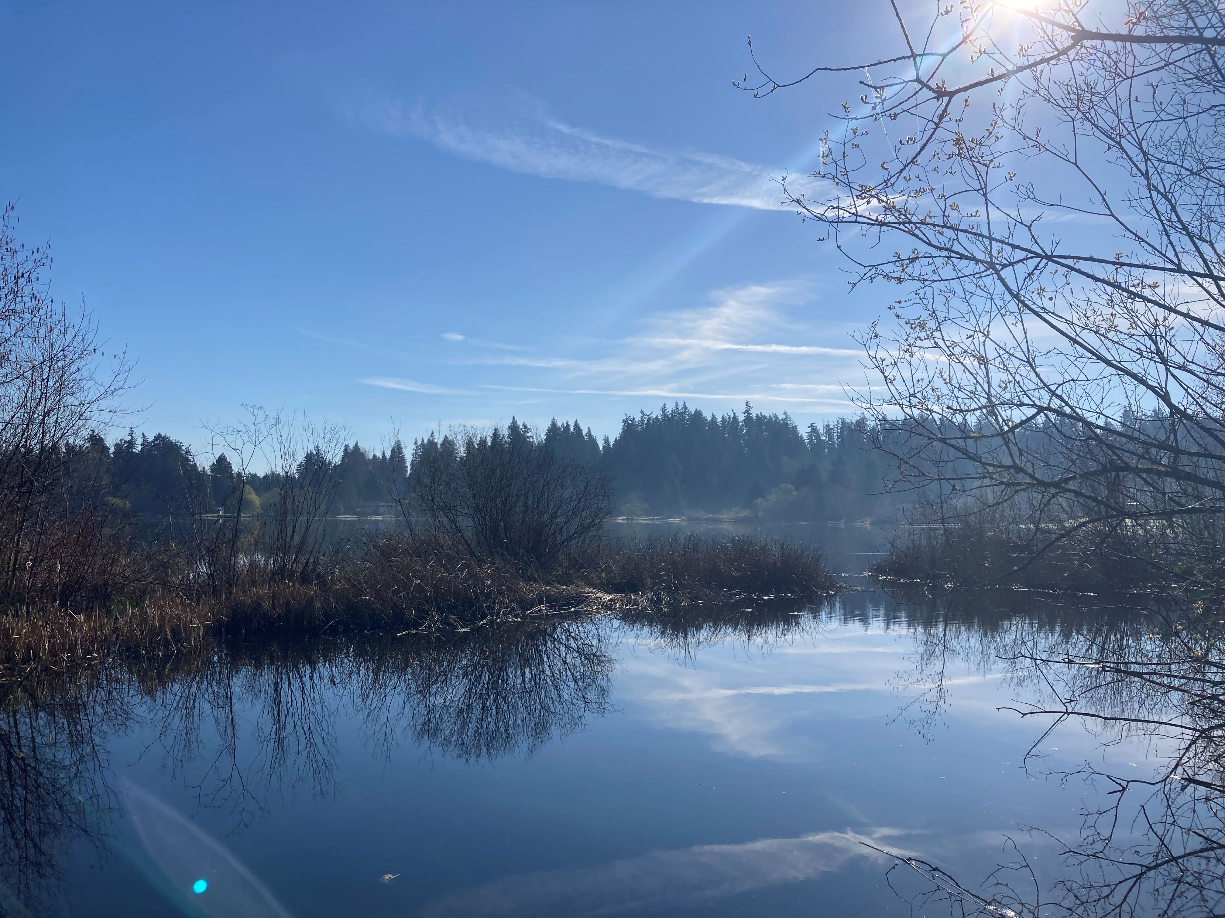
A clear brisk day at the lake. Photo by Anna 9300.
No phantoms to be found here, just a beautiful lake within Bellevue’s city limits. When the fog is out in the morning, the lake certainly gives off an eerie vibe, but no matter the time of day or year, the trail that goes around the lake is a great urban hike for all ages and experience levels. The trail also takes you past Lake Hills Park, which has a playground, picnic area and play fields.
> Plan your hike on the Phantom Lake Loop using WTA's Hiking Guide
Candy Mountain Trail
Location: Central Washington > Tri-Cities
Length: 3.6 miles, roundtrip
Elevation gain: 555 feet
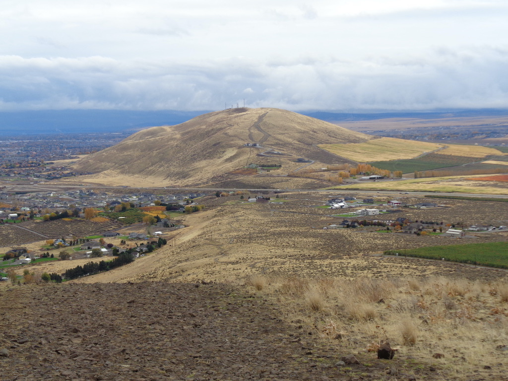
Great views of Badger Mountain from the summit. Photo by RichP.
Trick or treat! This volunteer-built trail is relatively mild up to the top of the sweetly-named mountain. In exchange for hiking up to the top, you’ll get views of the Tri-Cities area and Badger Mountain just next door. Please take care to stay on the trail as the mountain suffered a fire in 2017 and the terrain is very sensitive.
> Plan your hike on the Candy Mountain Trail using WTA's Hiking Guide
Fallen Leaf Lake
Location: Southwest Washington > Vancouver area
Length: 1.4 miles, roundtrip
Elevation gain: 500 feet
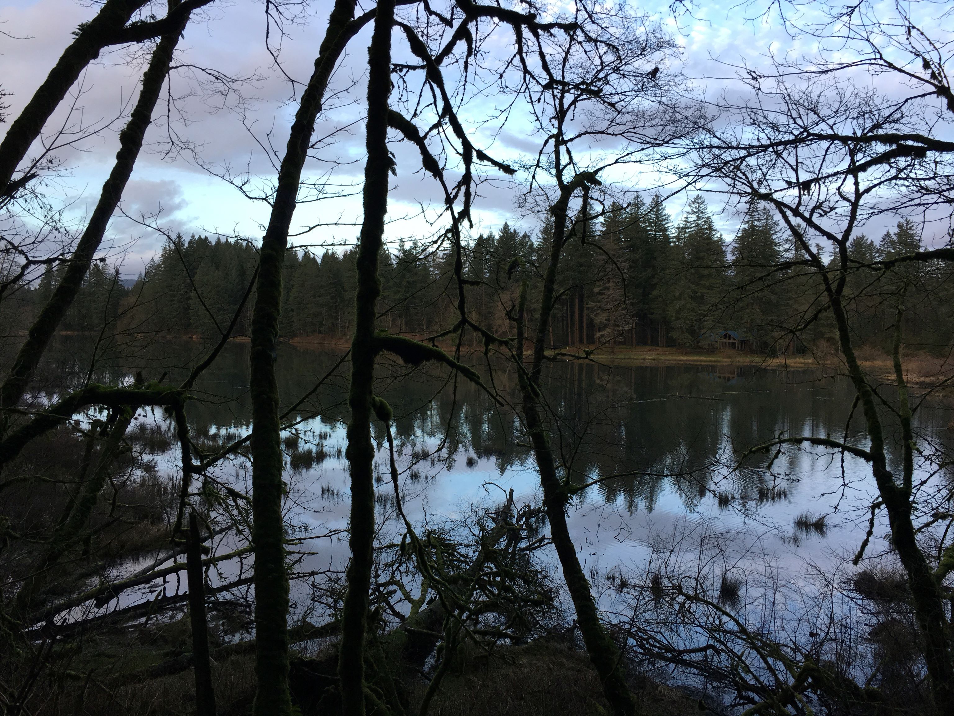
The lake is beautiful on a cloudy or sunny day. Photo by todash19.
Don’t be surprised if you run into many a fallen leaf at this Camas urban park in autumn! The trail system takes you next to the lake and connects to the Lacamas Heritage or Round Lake trails. Bring a guidebook and binoculars if wildlife watching or plant identification are your things — there’s plenty of flora and fauna to check out here.
> Plan your hike around Fallen Leaf Lake using WTA's Hiking Guide
Silver Shadow Loop
Location: Southwest Washington > Vancouver area
Length: 4.6 miles, roundtrip
Elevation gain: 994 feet
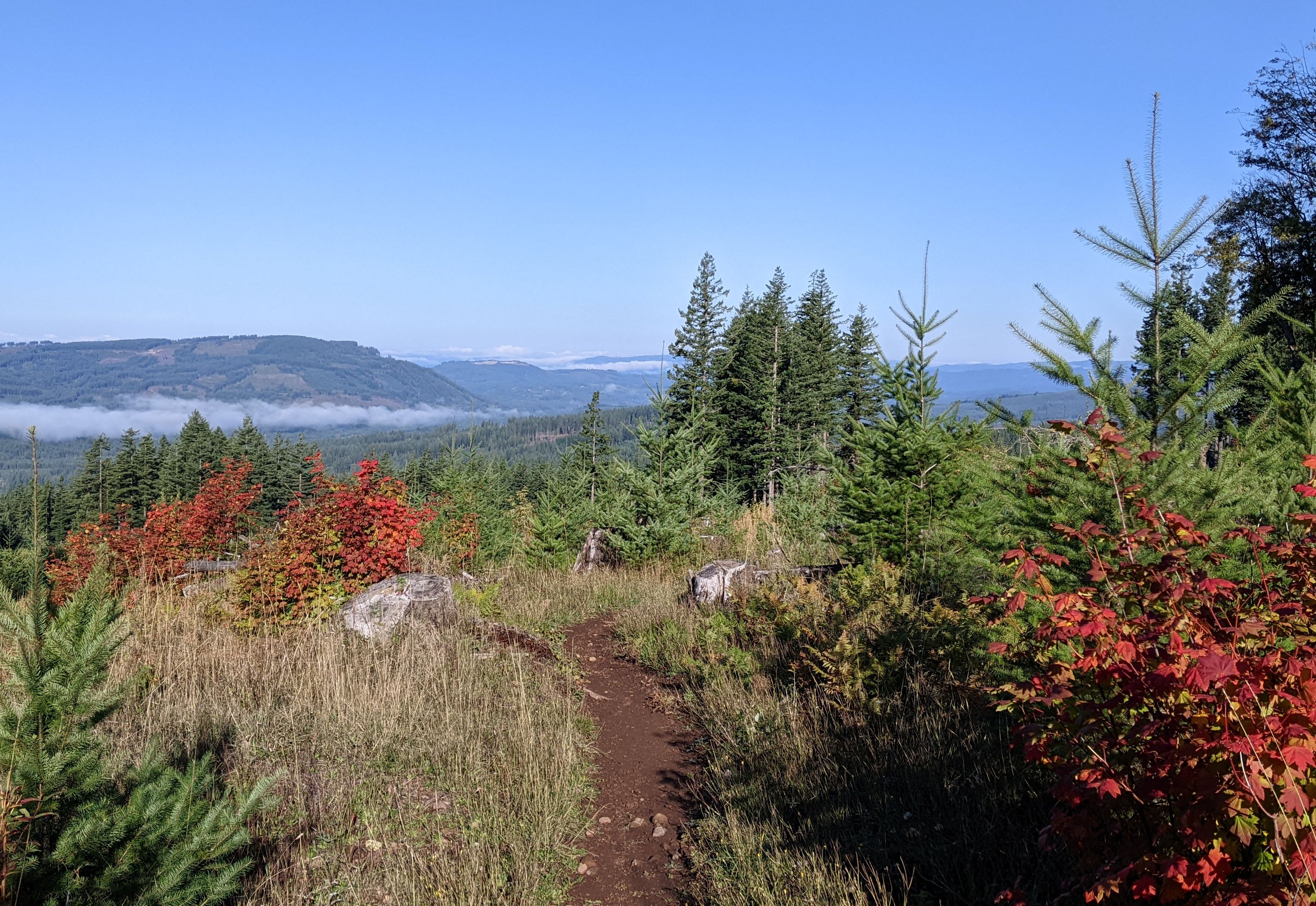
Fall reds at the top of the trail. Photo by Windwave.
It’s unlikely you’ll run into any shadowy figures lurking in the dark here — instead, expect open forests with trees in all stages of growth. This area has had its timber harvested in the past and is in the process of being replanted and regrown. For hikers, that means a lot of open air on this hike and likely only a few tree shadows here and there. Note that this trail gets snow in the winter — consider starting the loop at Rock Creek Campground, a few hundred feet lower than the Tarbell trailhead.
> Plan your hike on the Silver Shadow Loop using WTA's Hiking Guide
Fairy Dell Trail
Location: Puget Sound and Islands > Bainbridge Island
Length: 0.5 miles, roundtrip
Elevation gain: 106 feet
A walk on Fairy Dell Trail is brief but magical. Photo by Nathan Oestreich.
This short but enchanting trail takes you through a forested ravine worthy of fairies. For a brief adventure, enjoy a stroll among the ferns to visit a tidal inlet. If you'd like to extend your adventure, you can connect to the Cross-Island Trail by heading south to the Battle Point Trail.
> Plan your hike on the Fairy Dell Trail using WTA's Hiking Guide
Fort Townsend Historical STate Park
Location: Olympic Peninsula > Northern Coast
Length: 6.5 miles of trails
Elevation gain: varies
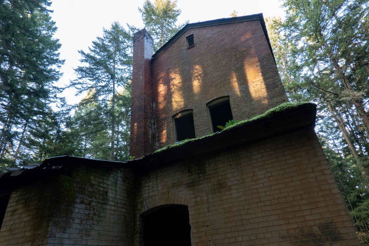
Some spooky old structures await hikers here. Photo by ejain.
This historical state park still has several structures from the original fort, built in 1856 by the U.S. Army. Walking through the park on a gloomy day, the old remnants leave a bit of an eerie vibe, reminiscent of a ghost town. Hikers can learn more about the military history in this area through a self-guided tour on an interpretive trail.
> Plan your hike at the Fort Townsend Historical State Park using WTA's Hiking Guide
Crooked Tree Trail — Roslyn Urban Forest
Location: Snoqualmie region > Salmon La Sac/Teanaway
Length: 3.8 miles, roundtrip
Elevation gain: 1,310 feet
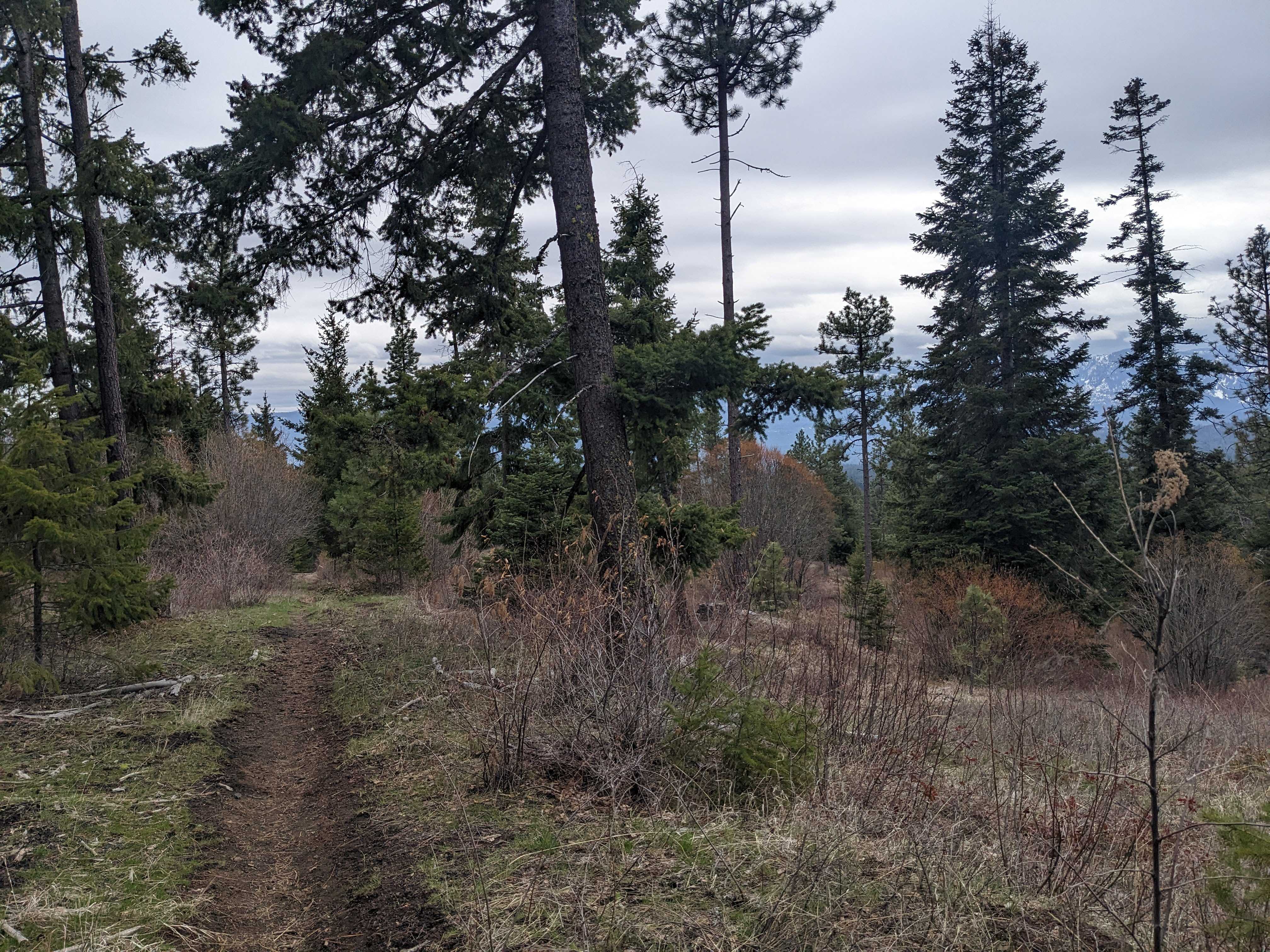
A gloomy day and some creaky trees. Photo by Tiffany Chou.
You might see a few creepy crooked trees along this trail, but you’ll also see snow-capped peaks across I-90 and sweeping views of the Teanaway if you make it all the way to the end of the trail. The trail network here in Roslyn Urban Forest is extensive, so you’ll also have plenty of options if you’re hoping to extend your hike.
> Plan your hike on the Crooked Tree Trail using WTA's Hiking Guide
Snake River Trail (Boyer Park Bluffs)
Location: Eastern Washington > Palouse and Blue Mountains
Length: 4.0 miles of trails
Elevation gain: 30 feet
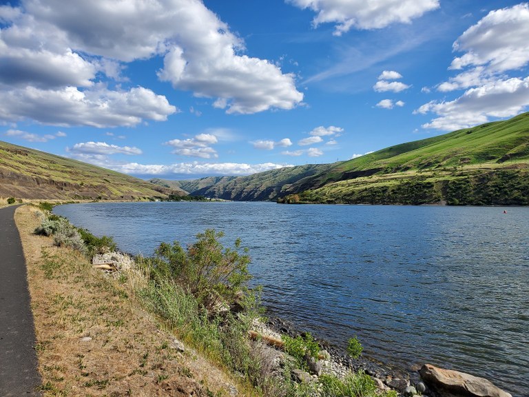
The Snake River Trail along its namesake. Photo by Aaron Czechkowski.
The Snake River winds like a spooky serpent, but this trail is anything but scary. The paved path with minimal elevation change offers beautiful views of the river, bluffs, and the Lower Granite Lock & Dam. With plenty of picnic tables and other amenities, it's perfect for a family day out. Just make sure to brush up on your rattlesnake safety skills before you go!
> Plan your hike at the Snake River Trail (Boyer Park Bluffs) using WTA's Hiking Guide
Candy Point Trail
Location: Central Washington > Grand Coulee
Length: 1.8 miles, roundtrip
Elevation gain: 800 feet
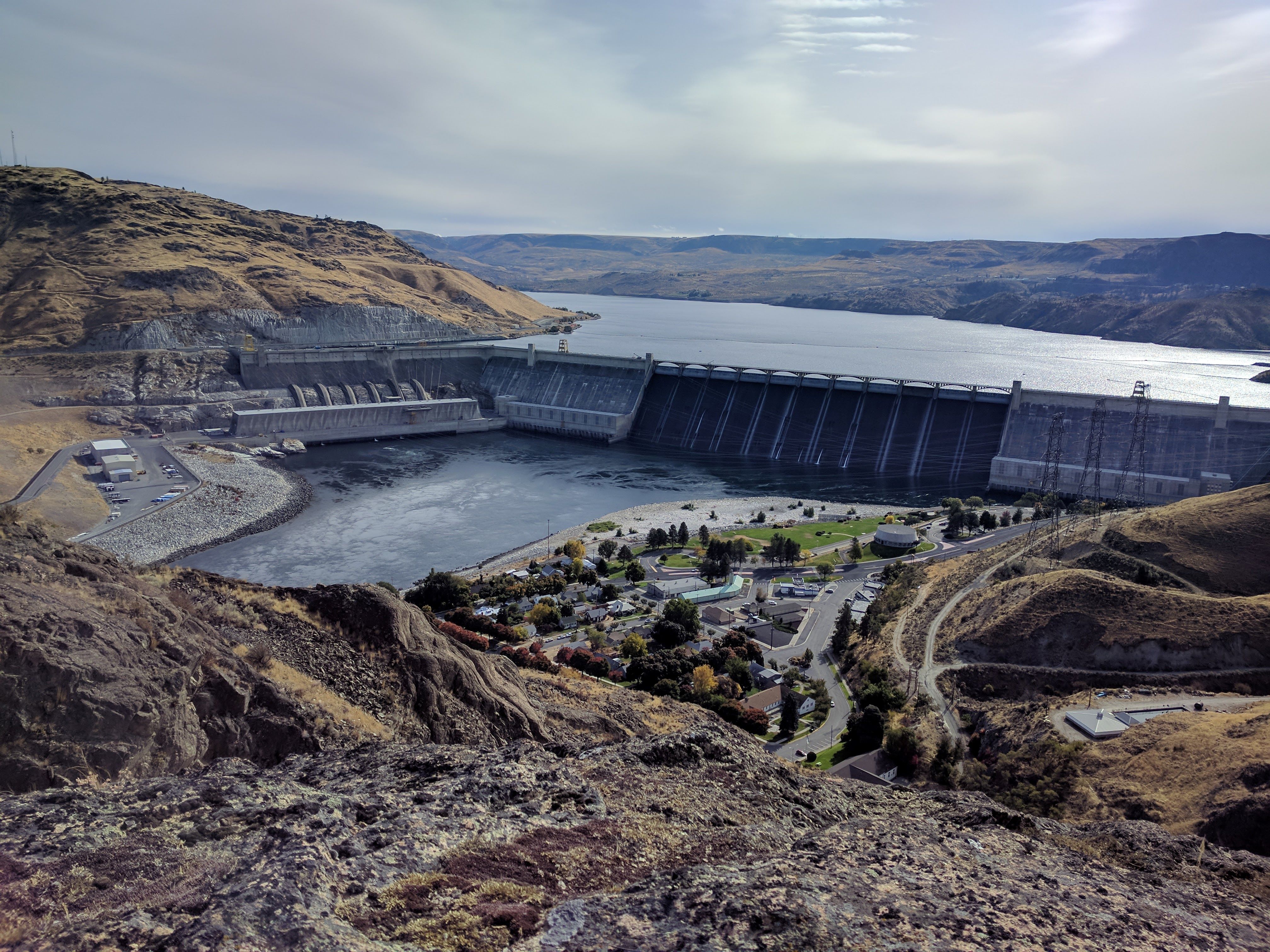
Looking down on the Grand Coulee Dam. Photo by Geoff Winslow.
Trick or treat … again! Another treat-named Central Washington trail, you’ll experience all that coulee country has to offer on this hike. You’ll have to work for it — hiking up many a rock step — but you’ll get high enough to catch some sweet views of the Grand Coulee Dam.
> Plan your hike on the Candy Point Trail using WTA's Hiking Guide
Crow Butte park
Location: Central Washington > Tri-Cities
Length: 6.0 miles of trails
Elevation gain: 250 feet

The view of Mount Hood from Crow Butte. Photo by Bob and Barb.
Crows are dressed for Halloween year-round, and in many cultures, these flocking birds (along with their raven cousins) are associated with the afterlife. But this island named after our flying friends is anything but spooky — you can hike, camp and even boat with gorgeous views of the Columbia Gorge and, on clear days, Mount Hood.
> Plan your hike at Crow Butte Park using WTA's Hiking Guide
Ladder Creek Falls
Location: North Cascades > North Cascades Highway - Highway 20
Length: 0.5 mile, roundtrip
Elevation gain: 359 feet
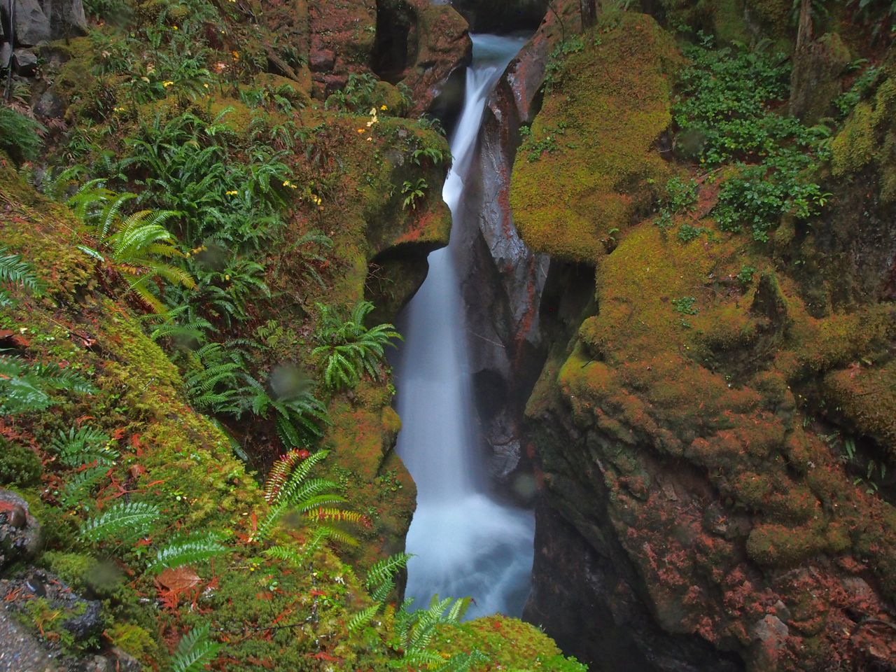
At night, these falls light up! Photo by Bob and Barb.
What better season for some “falls” than fall? This short hike — get ready for some stairs — takes you to these three-tiered falls. A suspension bridge allows hikers to cross the Skagit River from Newhalem to the trail that leads to the falls, and the falls are lit up with colored lights at night — a somewhat spooky but very pretty sight!
> Plan your hike to Ladder Creek Falls using WTA's Hiking Guide

