Not Over Yet! Hikes to Stretch Your Summer
Feel like you blinked and missed summer? You're in luck. Because August isn't the end. September is summer in Washington, and it also happens to be one of the best hiking months in Washington. Mosquitoes have chilled out, the heather and berry bushes are starting to turn colors and you won't wilt in the heat.
So before you kiss the summer season goodbye, here are a few great hikes to tackle before you turn your attention to the glories of autumn hiking.
Tips to Hike in Late SUMMER
- Pack an extra layer. The days are shorter and weather is less predicable this time of year, so be sure you add warm clothes, rain gear and put fresh batteries in your headlamp when you pack your 10 Essentials.
- Pack it in, pack it out. It's the end of a big hiking season. Help leave things better than you found them. Go beyond, and pick up trash along one of the routes.
- Stay safe in hunting season. Where to hike and what to wear (bright colors!) to safely share the trails during hunting season.
Central Washington
swakane Peak
Location: Wenatchee
Mileage: 7.4 miles, roundtrip
Elevation Gain: 2787 feet

Early October below Swakane Peak. Photo by johnwporter.
Swakane Peak is a hearty climb that will lead to expansive views across the Columbia River, as well as Waterville Plateau, Badger Mountain, Wenatchee, Missions Peak and a peek-a-boo view of Icicle Ridge to the west.
> Plan your trip using WTA's Hiking Guide
Ahtanum state forest - whites Ridge
Location: Yakima
Mileage: 10.9 miles, roundtrip
Elevation Gain: 1900 feet

A narrow trail running through Ahtanum State Forest. Photo by trip reporter wishfulwanderer.
Ahtanum State Forest has several trails to choose from, and the Whites Ridge trail will wind hikers through forests and past views of the Yakima Valley and Mount Adams.
> Plan your trip using WTA's Hiking Guide
Oak Creek Road - Bethel Ridge
Location: Yakima
Mileage: 6.5 miles, roundtrip
Elevation Gain: 800 feet

Dramatic lighting over Bethel Ridge. Photo by David Hagen.
If you’re looking for an easy to moderate shoulder season hike (or a winter snowshoe) with a good chance of seeing elk, give the Oak Creek Road west of Yakima a try. Pass through open shrub-steppe beneath nice basalt cliffs and outcrops with wide open views perfect for wildlife viewing.
> Plan your trip using WTA's HIking Guide
North Cascades
Sourdough Mountain
Location: North Cascades Hwy - Hwy 20
Mileage: 10.4 miles, roundtrip
Elevation Gain: 4870 feet

Fall colors popping along the trail. Photo by trip reporter kidz won't hike.
Sourdough Mountain was one of the first lookouts established by the U.S. Forest Service -- and for good reason. The breathtaking scenery at the summit, will make your jaw drop. The current lookout tower, which was built in 1933 and restored in 1998, is listed on the National Historic Lookout Register.
> Plan your trip using WTA's Hiking Guide
Goat Lake
Location: Mountain Loop Hwy
Mileage: 10.4 miles, roundtrip
Elevation Gain: 1400 feet

Photo by trip reporter Luffles.
Beautiful forest, a rushing creek, waterfalls of all shapes and sizes, history, and of course a large blue-green lake surrounded by snowy peaks. At 10.4 miles, the hike to Goat Lake can be either a day-hike or a quick overnight.
> Plan your trip using WTA's Hiking Guide
Mazama Park via Ridley Creek
Location: Mount Baker Area
Mileage: 7.0 miles, roundtrip
Elevation Gain: 2600 feet

The shelter at Mazama Park, looking up towards Park Butte. Photo by trip reporter heatheristall.
This trail has seen a lot of love over the years from WTA volunteer crews, and is a wonderful option for folks who want some classic Mount Baker views with a little more solitude than neighboring Park Butte. The route up is well forested, but eventually spits hikers out into incredible berry-filled meadows and a picturesque wooden shelter.
> Plan your trip using WTA's Hiking Guide
South Cascades
TRUMAN TRAIL-PUMICE PLAINS
Location: Mount St. Helens
Mileage: 10 miles, roundtrip
Elevation Gain: 200 feet

Unique landscape below Mount St. Helens. Photo by RacingSnail.
This area was filled with 600 feet of mud from the landslide triggered by the Mount St. Helens eruption in 1980. Today, birds and wildlife abound as the plants and flowers begin to regrow on the plains. The trail descends directly into the blast zone, and continues by the crater. Rock, ash, and mud dominate the terrain for two miles until reaching the Pumice Plains by Spirit Lake. Alongside the lake, take in views of the volcano and the region impacted by the eruption.
> Plan your trip using WTA's Hiking Guide
Quartz Creek
Location: Dark Divide
Mileage: 8.0 miles, roundtrip
Elevation Gain: 500 feet
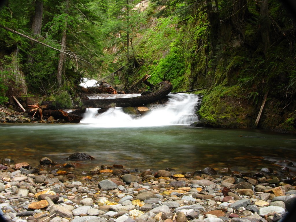
Straight Creek falls. Photo by rfschreiner.
A spectacular area for backpacking and day hiking, the Quartz Creek corridor is blessed with old-growth, waterfalls, and maybe even solitude. The trail carries hikers into the southeast corner of the Dark Divide Roadless Area, one of Washington's truly special places.
> Plan your trip using WTA's Hiking Guide
Buck Creek-Morrison Creek-Wicky Creek Loop
Location: Mount Adams Area
Mileage: 8.0 miles, roundtrip
Elevation Gain: 4100 feet
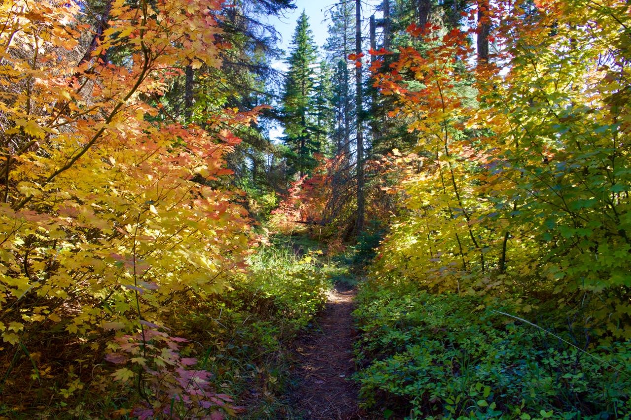
Lots of fall colors to be seen along Wicky Creek. Photo by Elementalll.
Get a taste for the south slopes of Mount Adams area when the snow is still in the high country on this eight mile loop combining the Buck Creek Trail, Morrison Creek Trail, and Wicky Creek Trail. Most of the area is rocky and heavily forested, including old-growth Ponderosa pine trees, as well as aspen, which are colorful in the fall.
> Plan your trip using WTA's Hiking Guide
Mount Rainier
GOLDEN GATE LOOP
Location: Paradise
Mileage: 4 miles, roundtrip
Elevation Gain: 1160 feet
Golden Gate Trail and the Tatoosh Range by David Hagen in mid-September.
With high elevation hubs at Paradise and Sunrise, Mount Rainier is a treasure trove of big view hikes. In some cases, they even start from the moment you climb out of a car. But heading away from parking lots even a mile or two will reward you with the hint of autumn color, the chance to spot some wildlife and a slightly different perspective. This little loop climbs up through popular meadows, and leaves plenty of time to explore other nearby trails or just sit and take in the view.
> Plan your trip using WTA's Hiking Guide
GLACIER BASIN & EMMONS MORAINE
Location: Sunrise/White River
Mileage: 3-6.5 miles, roundtrip
Elevation Gain: 1600 feet
WTA volunteers have invested a lot of love and hard work into helping Mount Rainier National Park repair this trail, and for good reason. It offers hikers views of Mount Rainier (when the clouds cooperate) and meadows on the way to the alpine basin. You can even catch a glimpse of the startling jade-green waters pouring off the mountain from the Emmons spur.
> Plan your trip using WTA's Hiking Guide
Klapatche Park
Location: Carbon River/Mowich
Mileage: 21.4 miles, roundtrip
Elevation Gain: 3300 feet

Photo by trip reporter buzzworm.
Looking for big miles? Experience one of the best wilderness camps on the Wonderland by sneaking in the back way! If you plan on making this an overnight, you'll need to snag a backcountry permit from Mount Rainier National Park but the trail to Klapatche could certainly be made into an epic day hike or trail run, too.
> Plan your trip using WTA's Hiking Guide
Eastern Washington
Gypsy Peak
Location: Selkirk Range
Mileage: 16.0 miles, roundtrip
Elevation Gain: 1750 feet
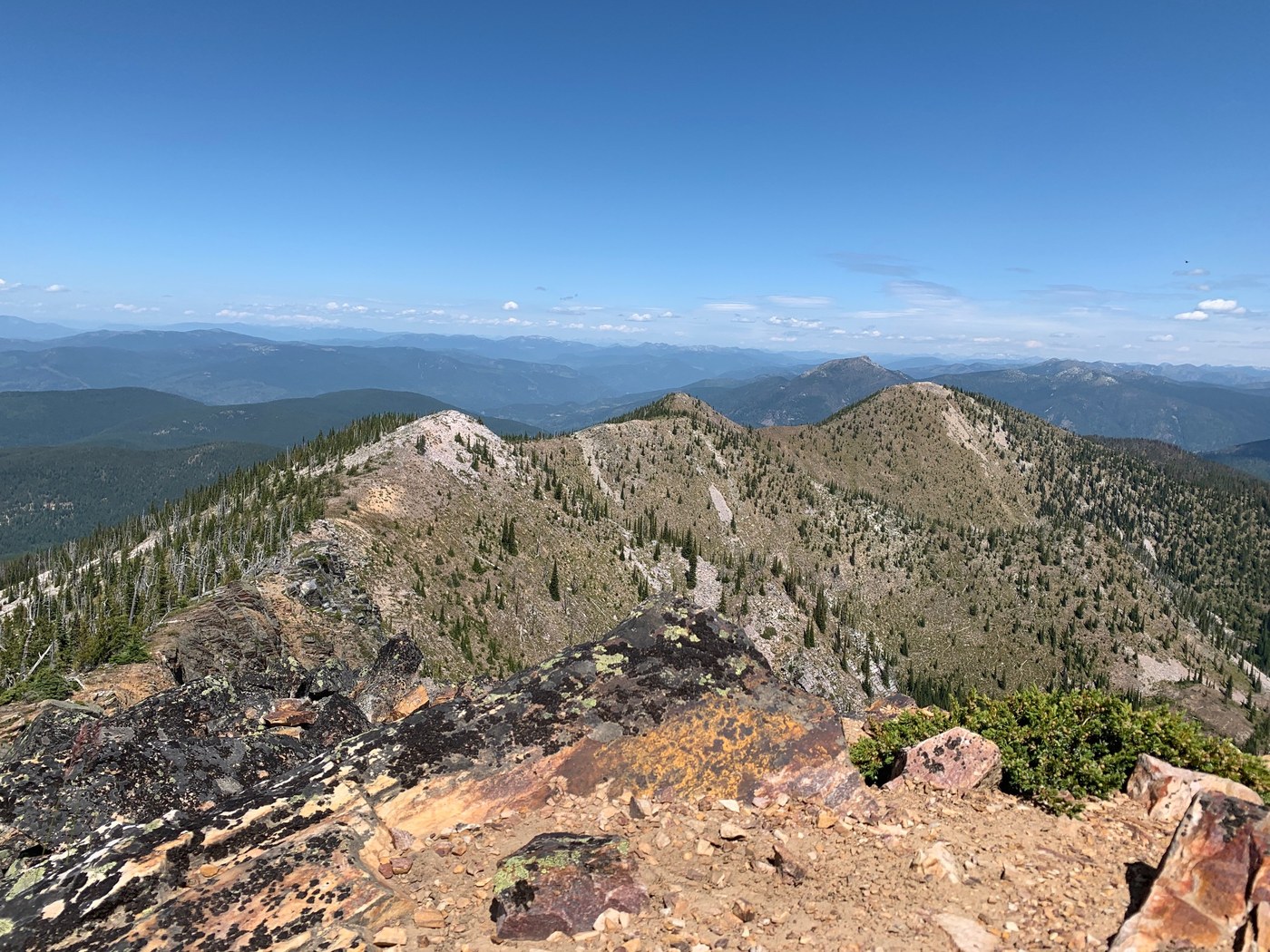
Photo by trip reporter Karen Daubert.
Eastern Washington’s highest peak may not stand particularly tall by Cascade standards, considering it’s only slightly more than half the height of Mount Rainier. All the same, the views from the summit of Gypsy Peak make the trip well worth it, with the added benefit of climbing a mountain in solitude. Due to its location in the heart of the Salmo–Priest Wilderness, visitors are most apt to share the trail with resident bighorn sheep or bears.
> Plan your trip using WTA's Hiking Guide
Mica Peak
Location: Spokane Area/Coeur d'Alene
Mileage: 15.36 miles of trail
Elevation Gain: 2000 feet
Mica Peak hosts several varieties of flora thanks to its elevation change from the parking area to the summit. While here, look for sub-alpine low brush to fragrant Ponderosa pine forest. Aspen and birch groves also thrive here, making the hill glow gold in the autumn. Visitors can also enjoy views of Spokane Valley and the rolling Palouse.
> Plan your trip using WTA's Hiking Guide
Mouth of the Tucannon
Location: Palouse and Blue Mountains
Mileage: 2.6 miles, roundtrip
Elevation Gain: 80 feet
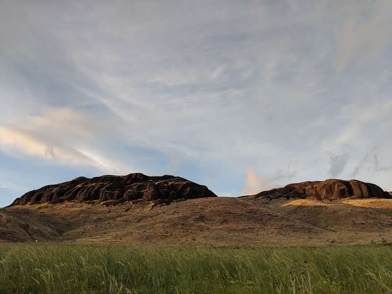
Lovely layers at the Mouth of the Tucannon. Photo by greymstreet.
The protected riparian area along the river provides a home for an abundance of wildlife in this otherwise dry landscape that will have you wishing for your binoculars, if you didn't bring them along. Take your time and look for large raptor nests in the old locust trees and evidence of beaver and porcupine nibbling along the riverbank. Deer tromp through the vegetation and the Tucannon is one of eastern Washington's best trout stream.
> Plan your trip using WTA's Hiking Guide
Central Cascades
Icicle Creek
Location: Leavenworth Area
Mileage: 4.0 miles, roundtrip

Photo by trip reporter geezerhiker.
This out-and-back trail winds through the forest with the sound of Icicle Creek in the valley below. The trail eventually meets Icicle Creek where it's joined by French Creek. There are two campsites there, one on either side of French Creek if you're looking for a short overnight, too.
> Plan your trip using WTA's Hiking Guide
TRonsen Ridge
Location: Snoqualmie Region -- Blewett Pass
Mileage: 8.0 miles, roundtrip
Elevation Gain: 1000 feet

Photo by trip reporter Janette Powell.
In a word, Tronsen Ridge is dynamic. It’s a place that evolves with each new season, showcasing the variance of Washington state as few trails can. Hike here in June and you’ll be met with bouquets of wildflowers dominating it’s many meadows. Come October, long after the flowers have died off, and you’ll find yourself bound-in by walls of golden larches.
> Plan your trip using WTA's Hiking Guide
THORP MOUNTAIN LOOKOUT VIA THORP CREEK
Location: Snoqualmie Region -- Salmon La Sac/Teanaway
Mileage: 7.4 miles, roundtrip
Elevation Gain: 2484 feet
Photo of the lookout in early October by PiperMarmalade.
Did you have a visit to a lookout on your summer to-do list? This trail off the east side of Snoqualmie Pass takes you to Thorp Mountain's lookout and some spectacular regional views. It’s possible to reach the lookout on top of Thorp Mountain four different ways. But this route offers a nice detour to a little lake, where you can have a snack and size up your objective before continuing on your way.
> Plan your trip using WTA's Hiking Guide
Olympic Peninsula
WAgonWheel Lake
Location: Hood Canal
Mileage: 5.8 miles, roundtrip
Elevation Gain: 3200 feet
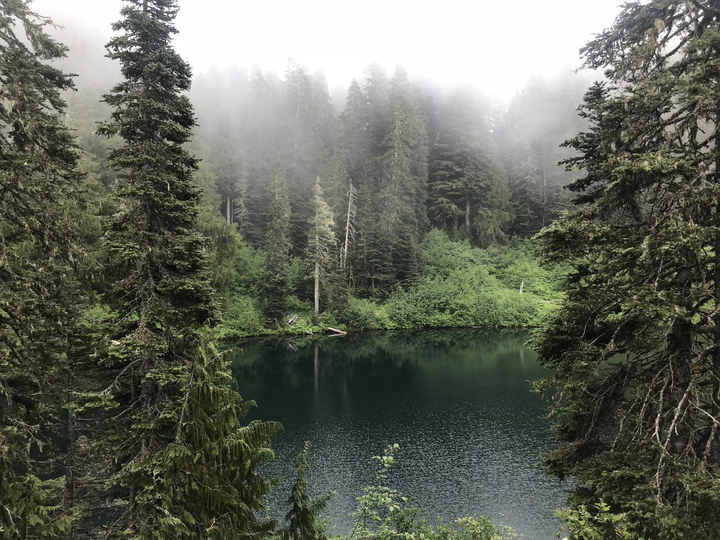
Photo by trip reporter jalaugh.
Wagonwheel Lake is all about the elevation gain. This trail makes for an excellent workout in a relatively short distance. The lake itself is small and the picnic spots are all high above it. But this hike is less about the destination than the journey. Enjoy a break before heading back down. If you have creaky knees, you’ll definitely want poles for the descent.
> Plan your trip using WTA's Hiking Guide
Deer Lake
Location: Northern Coast
Mileage: 8.0 miles, roundtrip
Elevation Gain: 1650 feet
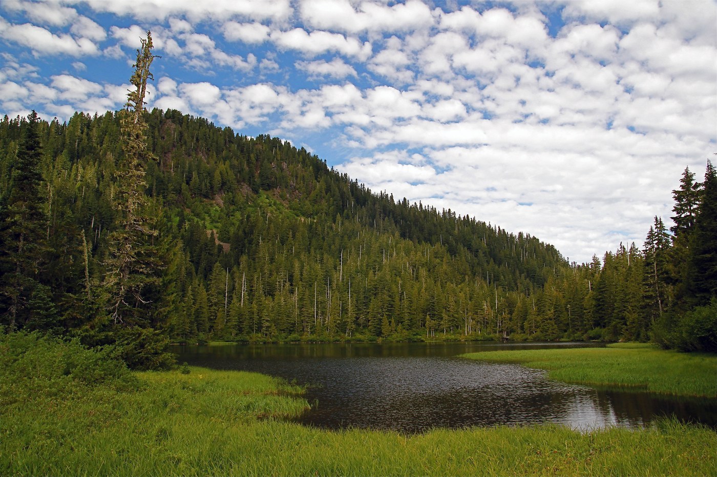
Photo by trip reporter Rugosus.
Deer Lake is begins in the lush forest near Sol Duc. Begin heading down the popular, well-maintained trail to Sol Duc Falls. Soon, pass the entrance to the Lover's Lane Trail, where the route begins climbing up to Deer Lake. Although referred to in the singular, it should be noted that there are actually two lakes side by side, though one is much smaller than the other. Along the way to the lake, hikers parallel Canyon Creek, which has several waterfalls. Stop to admire these and take some photos.
> Plan your trip using WTA's Hiking Guide
Colonel bob peak
Location: Hood Canal
Mileage: 8.2 miles, roundtrip
Elevation Gain: 3500 feet
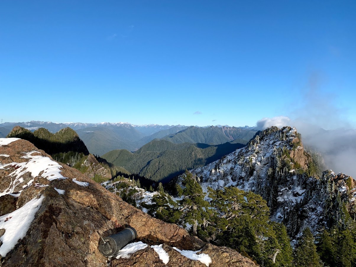
Photo by trip reporter Zugspitze.
This peak allows for unrivaled views of the Olympic Peninsula. Located on the southwest side of the park, views include the Pacific Ocean, Grays Harbor, Lake Quinault and the Quinault River, the Olympic rainforest and Mount Olympus. High above the Quinault River Valley, it is easy to drift away to hundreds of years ago, as many of the sights you see are mostly unchanged.


