10 Hikes in the Pasayten Wilderness
The vast and remote Pasayten Wilderness stretches across the northern border of our state and encompasses the east-west divide of the Cascades. As the largest Wilderness area in the state, it offers miles of expansive views, almost 150 peaks over 7,500 feet in elevation, 160 or more bodies of water and is home to a huge array of wildlife.
Although trails in an iconic location like the Pasayten should be in prime condition, decreases in trail maintenance funding and increasing occurrences of catastrophic wildfires have left portions of the wilderness difficult or nearly impossible to navigate by hikers and other trail users. To help combat this trail loss, WTA has chosen the Pasayten Wilderness as a priority area in our Lost Trails Found campaign. We'll be focusing on advocacy and trail work efforts in the Pasayten to help bring trails back from the brink and keep them open for generations to come.
As we embark on this work — there are still many accessible trails in the Pasayten ready for exploration. Try one of these six classic trails to give you a taste of what the Pasayten region has to offer.
Day Hike & Overnight Trips
Black Lake
Length: 8.0 miles, roundtrip
Elevation Gain: 750 feet
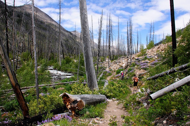
Photo by cascadehiker.
The 8-mile round-trip hike to Black Lake offers the chance to view the abundance of color that springs up after a wildfire. Toasted by a 2003 wildfire that left only a few fir islands in its wake, this corner of the Pasayten Wilderness is recovering nicely, with pioneering penstemon, paintbrush, fireweed and clematis clambering among the avalanche-deposited boulders littering the Lake Creek drainage.
Wildflowers are commonly encountered along the trail. Keep a look out for bunchberry, Columbia lily, fireweed, red paintbrush, shrubby and Chelan penstemon, and western blue clematis.
> Plan your trip to Black Lake using WTA's Hiking Guide
North Twentymile Peak
Length: 12.8 miles, roundtrip
Elevation Gain: 4387 feet
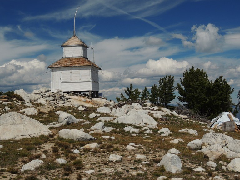
Photo by mtnfrog.
On this little used trail, hikers can see history, both natural and man-made. Large sections of the forest are recovering from the 2006 Tripod Complex Fire, and the two lookouts on the summit provide a glimpse of the 1920's and 1940's construction.
The summit area is an island of short alpine trees in a sea of recovering silver/black forest. The nearby views encompass the 2006 Tripod Complex which surrounds the peak, 2001 Thirtymile to the northeast, and 2003 Fawn Peak Complex to the west. The distant views include many prominent points: Remmel Mountain to the northwest, Windy Peak north-northeast, Tiffany Mountain to the southeast, and the Sawtooth Range directly south.
> Plan your visit to North Twentymile Peak using WTA's Hiking Guide
Horsehoe Basin
Length: 12.0 miles, roundtrip
Elevation Gain: 1550 feet
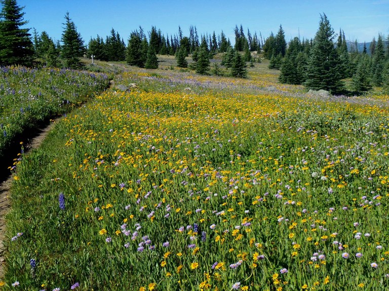
Photo by Hiking Buddies.
The drive to the trailhead may be long, but the destination is absolutely worth it. At the easterly edge of the Pasayten Wilderness, almost touching the Canadian border, lies Horseshoe Basin; a truly unique and beautifully remote place.
Horseshoe Basin is one of the few places in the Lower 48 to contain arctic tundra and is home to bears, deer and bighorn sheep, if you know where to look. Allow plenty of time to explore Horseshoe Basin by camping at the trailhead, where primitive camping without a water source is available. Bring plenty of water with you.
> Plan your visit to Horseshoe Basin using WTA's Hiking Guide
Silver Lake
Length: 9.2 miles, roundtrip
Elevation Gain: 2800 feet
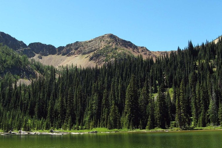
Photo by Rolan.
Starting at a little under 7,000 feet in elevation and never dropping below 6,200 feet, your hike on Buckskin Ridge will provide miles of dramatic views.
Get to know the area by trying to identify nearby peaks and the bright array of colorful wildflowers. Revel in Indian paintbrush, yellow aster, lupine, and countless other varieties as you gaze upon the lush fields below you. In autumn, stately larch groves add their color to the landscape, and in spring, babbling brooks accompany hikers on their way.
> Plan your visit to Silver Lake using WTA's Hiking Guide
Windy Pass
Length: 7.0 miles, roundtrip
Elevation Gain: 1300 feet
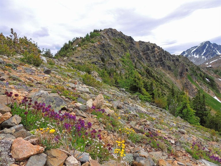
Photo by geezerhiker.
If you've got aching knees but still crave some mountain air, this is the hike for you. According to many, this is the most scenic and easily-accessible stretch of the Pacific Crest Trail in Washington State. The views of the North Cascades and Pasayten are magnificent almost every step of the way, and you don’t have to work terribly hard to reach them.
> Plan your visit to Windy Pass using WTA's Hiking Guide
Tiffany Mountain via freezeout ridge
Length: 4.2 miles, roundtrip
Elevation Gain: 1685 feet
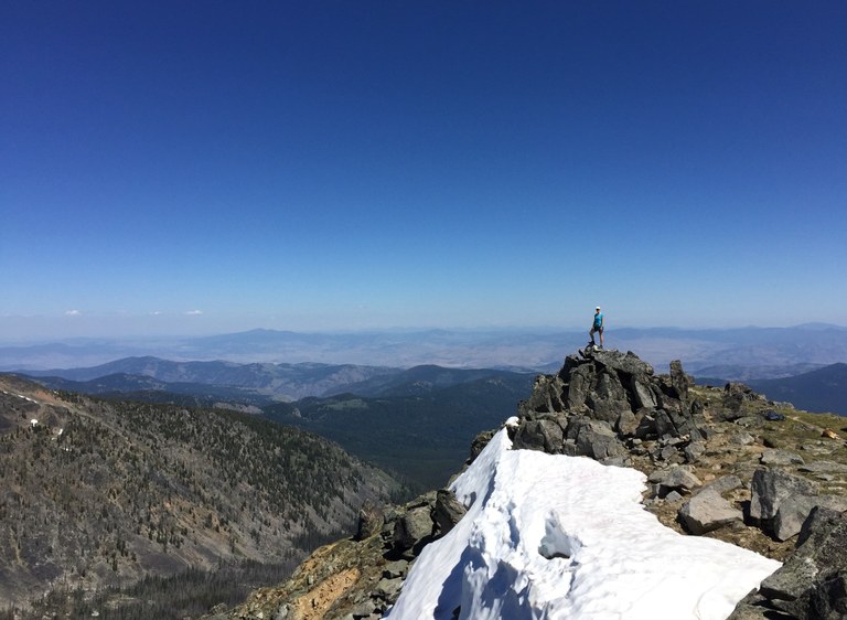
Photo by Becky108.
While the Tiffany Mountain trail isn't technically within the Pasayten Wilderness boundaries, it will give you incredible views into the vast wild! You'll start this trek at one of the higher trailheads in the state (6560 feet) and follow the trail even higher. In early summer, if the thinner air doesn't take your breath away, the flowers and views will.
The 360-degree views from the summit include the North Cascades to the west, the Loup Loup Pass area to the south, the Okanogan Highlands to the east, and peaks in British Columbia to the north. Little Tiffany Lake and Tiffany Lake are down to the northwest. From here, the local view of silver and black trees has a few pockets of green that survived the 2006 fire, and now you can even see your car at the trailhead. The expansive views pretty well explains the use of Tiffany Mountain as a lookout from 1931 to 1953. But now, all that remains are many rusty nails, a few anchors, and the fire sight mounting post.
> Plan your visit to Tiffany Mountain via Freezeout Ridge using WTA's Hiking Guide
Multi-Night Backpacking Trips
Hoping to spend more time exploring the wilderness? Luckily, the Pasayten's trail system is ripe with opportunities for create-your-own loops and long distance hiking opportunities. Pick up a hiking map and start planning your route today or try out one of our route options below.
Tips for backpacking in a Wilderness area:
- People. In general, no more than 12 heartbeats (people, dogs, horses etc.) should hike together as a group in wilderness.
- Permits. If you are staying overnight, you will need to fill out a self-issued wilderness permit at the trailhead.
- Pack It In, Pack It Out. As with any trail, practice Leave No Trace ethics.
- Stay hydrated. Parts of the Pasayten can lack abundant water sources, so check conditions before you go, plan your sources carefully and file a trip report when you return.
BUCKSKIN RIDGE - WEST FORK PASAYTEN RIVER LOOP
Length: 32 miles
Highest Point: 7300 feet

Buckskin Lake. Photo by trip reporter D.Baxter.
Pair Buckskin Ridge with the West Fork Pasayten River for a superb 32-mile loop through the Pasayaten Wilderness that starts and ends at Slate Pass. As you head north on the high and wild Buckskin Ridge Trail, the vista filled with copper, gold and gunmetal peaks will pull you forward step by step. After 16 miles, you'll be close to the confluence of the West and Middle Forks of the Pasayaten River. From here, you will travel 15.5 miles through lodgepole pine and lupine meadows as the West Fork of the Pasayten River Trail carries you back to Slate Pass. You'll find dispersed campsites along the trail, as you enjoy both scenery and solitude.
> Plan your loop on Buckskin Ridge using WTA's Hiking Guide
CATHEDRAL PASS LOOP
Length: 44.7 miles
Elevation Gain: 4000 feet
Highest Point: 7800 feet

A tarn above upper Cathedral Lake. Photo by trip reporter MazamaMike.
The 44-mile loop through Cathedral Pass offers some of the best scenery that the Boundary Trail has to offer. Start at the 30-Mile trailhead on the Chewuch River out of Winthrop. Hike 10 easy miles along the river, then make the climb to 6,870-ft Remmel Lake and many camps. Views of surrounding peaks will keep you entranced. Continue six more miles to circle Amphitheater Mountain, passing upper Cathedral Lake to 7,600-ft Cathedral Pass. Hike five miles east in mostly open terrain to Tungsten Mine, then close the loop by hiking six miles down the Tungsten Trail, then finish back down the Chewuch River.
> Plan your trip on the Cathedral Pass Loop using WTA's Hiking Guide
BILLY GOAT LOOP
Length: 50 miles
Elevation Gain: 5000 feet
Highest Point: 7500 feet

A previously burned area along the Billy Goat Trail. Photo by trip reporter Wilderness Lvr.
Explore multiple alpine lakes and mountain passes on a great backpacking loop for solitude seekers. Start your trip at the Billy Goat Trailhead and hike 7.3 miles to a campsite along Larch Creek, crossing through Billy Goat Pass, Three Fools Pass, and over Diamond Creek. Hike four miles among wildflowers to 7,500-foot McCall Gulch, the highpoint of the trail. Continue 3.7 miles to Peeve Pass and allow yourself two nights to camp here, as there are many excellent day hike options nearby.
After you've taken a swim in Quartz Lake or scrambled up 8,274-foot Sheep Mountain, return to Larch Creek for your final night in the Pasayten and hike out the next day.
> Plan your trip on the Billy Goat Loop using WTA's Hiking Guide
HART'S PASS TO HOLMAN PASS
Length: 28 miles
Highest Point: 6900 feet

A few colorful wildflowers popping up along the PCT. Photo by LghtChsr_MtnLvr.
Start high and stay high on this stunning section of the Pacific Crest Trail, crossing through Hart's Pass, Windy Pass, and Holman Pass. Take in views of the Pasayten River Valley and the surrounding North Cascades as you traverse through alpine meadows.
> Plan your trip to Hart's Pass to Holman Pass using WTA's Hiking Guide

